
 Bokamoso
Buysdorp
Xihosana
Ga-Sekororo
Ga-Rankuwa
Three Sisters
George
Haenertsburg
Polokwane
Bokamoso
Buysdorp
Xihosana
Ga-Sekororo
Ga-Rankuwa
Three Sisters
George
Haenertsburg
Polokwane
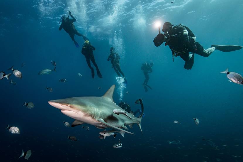
Aliwal Shoal on the map, Umkomaas, South Africa
Photo
Where is located Aliwal Shoal
Aliwal Shoal — local attraction, which is located at no data and belongs to the category — -. Average visitor rating for this place — 4.7 (according to 7 ratings, information from open sources and relevant for 2022).
Exact location — Aliwal Shoal, marked on the map with a red marker.
You can get directions to Aliwal Shoal on the map from your location.
What else is interesting in Umkomaas? You can see all the sights if you go to the city page.
Coordinates
Aliwal Shoal, South Africa coordinates in decimal format: latitude — -30.219068067681306, longitude — 30.800085484764082. When converted to degrees, minutes, seconds Aliwal Shoal has the following coordinates: -30°13′8.65 north latitude and 30°48′0.31 east longitude.
Nearby cities
The largest cities that are located nearby:
- Durban — 44 km
- Pietermaritzburg — 77 km
- Richards Bay — 199 km
- Vryheid — 269 km
- Newcastle — 284 km
- Maseru
 (Lesotho) — 333 km
 - Botshabelo — 405 km
- Queenstown — 408 km
- East London — 410 km
- Manzini
 (Swaziland) — 412 km
 - Bisho — 427 km
- Bethal — 434 km
- Embalenhle — 437 km
- Virginia — 448 km
- Kroonstad — 448 km
- Bloemfontein — 457 km
- Welkom — 466 km
- Nigel — 480 km
- Vereeniging — 481 km
Distance to the capital
Distance to the capital (Pretoria) is about — 560 km.