 Warner Robins
Wantagh
Bethel
Misty Hill Farm
United States
Wakonda Beach (R33) Airport
Wilmington
Poland
Miami International Airport
Warner Robins
Wantagh
Bethel
Misty Hill Farm
United States
Wakonda Beach (R33) Airport
Wilmington
Poland
Miami International Airport
Kurtz Woods State Natural Area on the map, Port Washington, United States
Photo
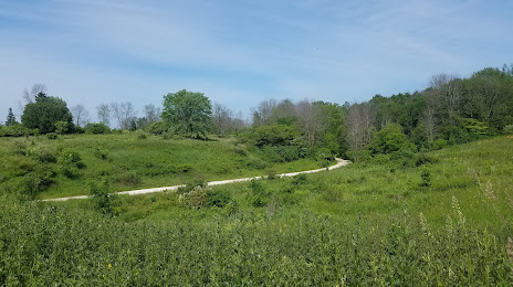
Where is located Kurtz Woods State Natural Area
Kurtz Woods State Natural Area — local attraction, which is located at no data and belongs to the category — -. Average visitor rating for this place — 4.8 (according to 25 ratings, information from open sources and relevant for 2022).
Exact location — Kurtz Woods State Natural Area, marked on the map with a red marker.
You can get directions to Kurtz Woods State Natural Area on the map from your location.
What else is interesting in Port Washington? You can see all the sights if you go to the city page.
Coordinates
Kurtz Woods State Natural Area, United States coordinates in decimal format: latitude — 43.45858794034899, longitude — -87.8152466750537. When converted to degrees, minutes, seconds Kurtz Woods State Natural Area has the following coordinates: 43°27′30.92 north latitude and -87°48′54.89 east longitude.
Nearby cities
The largest cities that are located nearby:
- Milwaukee — 39 km
- Green Bay — 126 km
- Madison — 128 km
- Rockford — 159 km
- Chicago — 168 km
- Naperville — 182 km
- Aurora — 184 km
- Grand Rapids — 185 km
- Joliet — 207 km
- South Bend — 232 km
- Lansing — 279 km
- Peoria — 331 km
- Flint — 341 km
- Fort Wayne — 342 km
- Ann Arbor — 360 km
- Sterling Heights — 404 km
- Toledo — 405 km
- Warren — 408 km
- Detroit — 412 km
Distance to the capital
Distance to the capital (Washington) is about — 1033 km.