
 Belém
Maranguape
Paranaguá
Paranaguá
Monte Alegre
Alvorada de Minas
Bragança
Laguna
Ibiporã
Belém
Maranguape
Paranaguá
Paranaguá
Monte Alegre
Alvorada de Minas
Bragança
Laguna
Ibiporã
State Park Site Foundation on the map, Crato, Brazil
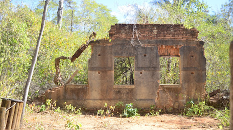
Photo
Where is located State Park Site Foundation
State Park Site Foundation — local attraction, which is located at Rua José Franca de Alencar s/n - Seminário, Crato - CE, 63010-100, Brazil and belongs to the category — park. Average visitor rating for this place — 4.7 (according to 643 ratings, information from open sources and relevant for 2022).
Exact location — State Park Site Foundation, marked on the map with a red marker.
You can get directions to State Park Site Foundation on the map from your location.
What else is interesting in Crato? You can see all the sights if you go to the city page.
Coordinates
State Park Site Foundation, Brazil coordinates in decimal format: latitude — -7.233767511988421, longitude — -39.43880817577047. When converted to degrees, minutes, seconds State Park Site Foundation has the following coordinates: -7°14′1.56 north latitude and -39°26′19.71 east longitude.
Nearby cities
The largest cities that are located nearby:
- Juazeiro do Norte — 11 km
- Petrolina — 267 km
- Mossoro — 321 km
- Maracanaú — 382 km
- Campina Grande — 388 km
- Caruaru — 394 km
- Caucaia — 396 km
- Fortaleza — 399 km
- Arapiraca — 409 km
- Teresina — 442 km
- Timon — 444 km
- Parnamirim — 478 km
- Aracaju — 483 km
- Maceió — 484 km
- Santa Rita — 488 km
- Natal — 490 km
- Camaragibe — 493 km
- Jaboatão dos Guararapes — 494 km
- João Pessoa — 501 km