
 Belém
Maranguape
Paranaguá
Paranaguá
Monte Alegre
Alvorada de Minas
Bragança
Laguna
Ibiporã
Belém
Maranguape
Paranaguá
Paranaguá
Monte Alegre
Alvorada de Minas
Bragança
Laguna
Ibiporã
National Forest Araripe-Apodi on the map, Crato, Brazil
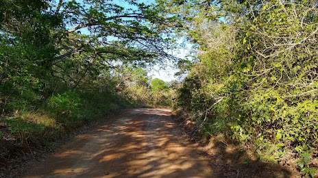
Photo
Where is located National Forest Araripe-Apodi
National Forest Araripe-Apodi — local attraction, which is located at CE-060, 13222, Barbalha - CE, 63180-000, Brazil and belongs to the category — national forest. Average visitor rating for this place — 4.8 (according to 725 ratings, information from open sources and relevant for 2022).
Exact location — National Forest Araripe-Apodi, marked on the map with a red marker.
You can get directions to National Forest Araripe-Apodi on the map from your location.
What else is interesting in Crato? You can see all the sights if you go to the city page.
Coordinates
National Forest Araripe-Apodi, Brazil coordinates in decimal format: latitude — -7.35999426743291, longitude — -39.428557893906294. When converted to degrees, minutes, seconds National Forest Araripe-Apodi has the following coordinates: -7°21′35.98 north latitude and -39°25′42.81 east longitude.
Nearby cities
The largest cities that are located nearby:
- Juazeiro do Norte — 11 km
- Petrolina — 267 km
- Mossoro — 321 km
- Maracanaú — 382 km
- Campina Grande — 388 km
- Caruaru — 394 km
- Caucaia — 396 km
- Fortaleza — 399 km
- Arapiraca — 409 km
- Teresina — 442 km
- Timon — 444 km
- Parnamirim — 478 km
- Aracaju — 483 km
- Maceió — 484 km
- Santa Rita — 488 km
- Natal — 490 km
- Camaragibe — 493 km
- Jaboatão dos Guararapes — 494 km
- João Pessoa — 501 km