
 Belém
Maranguape
Paranaguá
Paranaguá
Monte Alegre
Alvorada de Minas
Bragança
Laguna
Ibiporã
Belém
Maranguape
Paranaguá
Paranaguá
Monte Alegre
Alvorada de Minas
Bragança
Laguna
Ibiporã
Área de Proteção Ambiental de Cananéia-Iguape-Peruíbe on the map, Iguape, Brazil
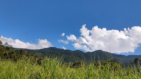
Photo
Where is located Área de Proteção Ambiental de Cananéia-Iguape-Peruíbe
Área de Proteção Ambiental de Cananéia-Iguape-Peruíbe — local attraction, which is located at R. da Saudade, 350, Iguape - SP, 11920-000, Brazil and belongs to the category — protected site. Average visitor rating for this place — 4.6 (according to 5506 ratings, information from open sources and relevant for 2022).
Exact location — Área de Proteção Ambiental de Cananéia-Iguape-Peruíbe, marked on the map with a red marker.
You can get directions to Área de Proteção Ambiental de Cananéia-Iguape-Peruíbe on the map from your location.
What else is interesting in Iguape? You can see all the sights if you go to the city page.
Coordinates
Área de Proteção Ambiental de Cananéia-Iguape-Peruíbe, Brazil coordinates in decimal format: latitude — -24.647465122668617, longitude — -47.59516047291132. When converted to degrees, minutes, seconds Área de Proteção Ambiental de Cananéia-Iguape-Peruíbe has the following coordinates: -24°38′50.87 north latitude and -47°35′42.58 east longitude.
Nearby cities
The largest cities that are located nearby:
- Paranaguá — 131 km
- Itapetininga — 133 km
- Sorocaba — 134 km
- Cotia — 138 km
- Praia Grande — 139 km
- Itapevi — 143 km
- Taboão da Serra — 143 km
- São Vicente — 143 km
- Cubatão — 146 km
- Jandira — 146 km
- Diadema — 148 km
- Santos — 149 km
- Barueri — 149 km
- Carapicuiba — 150 km
- São Bernardo do Campo — 151 km
- Osasco — 151 km
- Guarujá — 153 km
- Saint Andrew — 154 km
- São Caetano do Sul — 157 km