 Pointe-à-la-Croix
Sainte-Irène, Quebec
Marsoui
Hecla
Muskrat Dam
Wunnummin Lake
Sainte-Brigitte-de-Laval
Drayton
Mauricie
Pointe-à-la-Croix
Sainte-Irène, Quebec
Marsoui
Hecla
Muskrat Dam
Wunnummin Lake
Sainte-Brigitte-de-Laval
Drayton
Mauricie
Parc de la Rivière-des-Mille-Îles on the map, Boisbriand, Canada
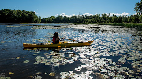
Photo
Where is located Parc de la Rivière-des-Mille-Îles
Parc de la Rivière-des-Mille-Îles — local attraction, which is located at 345 Bd Sainte-Rose, Laval, QC H7L 1M7, Canada and belongs to the category — park. Average visitor rating for this place — 4.5 (according to 1220 ratings, information from open sources and relevant for 2022).
Exact location — Parc de la Rivière-des-Mille-Îles, marked on the map with a red marker.
You can get directions to Parc de la Rivière-des-Mille-Îles on the map from your location.
What else is interesting in Boisbriand? You can see all the sights if you go to the city page.
Coordinates
Parc de la Rivière-des-Mille-Îles, Canada coordinates in decimal format: latitude — 45.60113910021965, longitude — -73.83378017488855. When converted to degrees, minutes, seconds Parc de la Rivière-des-Mille-Îles has the following coordinates: 45°36′4.1 north latitude and -73°50′1.61 east longitude.
Nearby cities
The largest cities that are located nearby:
- Laval — 10 km
- Montreal — 24 km
- Longueuil — 27 km
- Trois-Rivières — 128 km
- Gatineau — 145 km
- Sherbrooke — 154 km
- Levis — 233 km
- Quebec — 236 km
- Kingston — 259 km
- Syracuse
 (United States) — 339 km
 - Manchester (United States) — 348 km
- Saguenay — 372 km
- Amherst (United States) — 378 km
- Lowell (United States) — 388 km
- Springfield (United States) — 401 km
- Worcester (United States) — 406 km
- Rochester (United States) — 407 km
- Cambridge (United States) — 422 km
- Boston (United States) — 425 km
Distance to the capital
Distance to the capital (Ottawa) is about — 147 km.