
 Belém
Maranguape
Paranaguá
Paranaguá
Monte Alegre
Alvorada de Minas
Bragança
Laguna
Ibiporã
Belém
Maranguape
Paranaguá
Paranaguá
Monte Alegre
Alvorada de Minas
Bragança
Laguna
Ibiporã
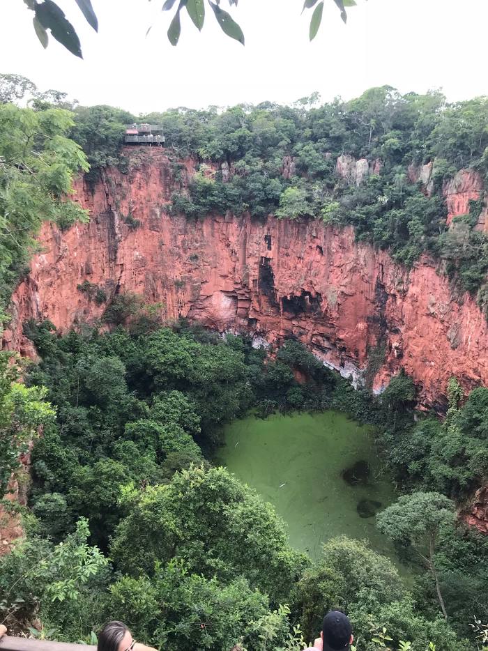
Buraco das Araras on the map, Bonito, Brazil
Photo
Where is located Buraco das Araras
Buraco das Araras — local attraction, which is located at no data and belongs to the category — -. Average visitor rating for this place — 4.6 (according to 128 ratings, information from open sources and relevant for 2022).
Exact location — Buraco das Araras, marked on the map with a red marker.
You can get directions to Buraco das Araras on the map from your location.
What else is interesting in Bonito? You can see all the sights if you go to the city page.
Coordinates
Buraco das Araras, Brazil coordinates in decimal format: latitude — -21.49190210859486, longitude — -56.40316487551002. When converted to degrees, minutes, seconds Buraco das Araras has the following coordinates: -21°29′30.85 north latitude and -56°24′11.39 east longitude.
Nearby cities
The largest cities that are located nearby:
- Campo Grande — 206 km
- Dourados — 210 km
- Luque
 (Paraguay) — 469 km
 - Asuncion (Paraguay) — 474 km
- Fernando De La Mora (Paraguay) — 476 km
- San Lorenzo (Paraguay) — 477 km
- Capiata (Paraguay) — 479 km
- Lambare (Paraguay) — 480 km
- Ciudad del Este (Paraguay) — 520 km
- Cascavel — 521 km
- Foz do Iguaçu — 521 km
- Maringá — 527 km
- Presidente Prudente — 533 km
- Rondonópolis — 551 km
- Apucarana — 575 km
- Formosa
 (Argentina) — 584 km
 - Várzea Grande — 607 km
- Cuiaba — 612 km
- Birigui — 633 km