
 Belém
Maranguape
Paranaguá
Paranaguá
Monte Alegre
Alvorada de Minas
Bragança
Laguna
Ibiporã
Belém
Maranguape
Paranaguá
Paranaguá
Monte Alegre
Alvorada de Minas
Bragança
Laguna
Ibiporã
Beach Grauca on the map, Caravelas, Brazil
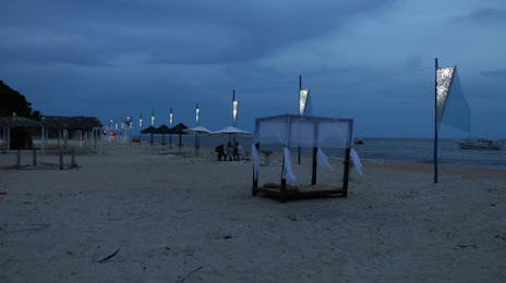
Photo
Where is located Beach Grauca
Beach Grauca — local attraction, which is located at R. Luércio Siquara, 2-142 - Ponta da Areia, Caravelas - BA, 45900-000, Brazil and belongs to the category — tourist attraction. Average visitor rating for this place — 4.5 (according to 684 ratings, information from open sources and relevant for 2022).
Exact location — Beach Grauca, marked on the map with a red marker.
You can get directions to Beach Grauca on the map from your location.
What else is interesting in Caravelas? You can see all the sights if you go to the city page.
Coordinates
Beach Grauca, Brazil coordinates in decimal format: latitude — -17.72921997465763, longitude — -39.181140375569576. When converted to degrees, minutes, seconds Beach Grauca has the following coordinates: -17°43′45.19 north latitude and -39°10′52.11 east longitude.
Nearby cities
The largest cities that are located nearby:
- Porto Seguro — 144 km
- Linhares — 202 km
- Teófilo Otoni — 237 km
- Colatina — 246 km
- Serra — 285 km
- Cariacica — 304 km
- Valadares Governor — 308 km
- Vila Velha — 308 km
- Itabuna — 326 km
- Ilhéus — 326 km
- Guarapari — 349 km
- Vitória da Conquista — 360 km
- Cachoeiro de Itapemirim — 394 km
- Coronel Fabriciano — 402 km
- Jequié — 437 km
- Montes Claros — 499 km
- Sabará — 531 km
- Salvador — 533 km
- Santa Luzia — 537 km