
 Belém
Maranguape
Paranaguá
Paranaguá
Monte Alegre
Alvorada de Minas
Bragança
Laguna
Ibiporã
Belém
Maranguape
Paranaguá
Paranaguá
Monte Alegre
Alvorada de Minas
Bragança
Laguna
Ibiporã
Municipal Park of Mangabeiras (Parque Municipal das Mangabeiras) on the map, Raposos, Brazil
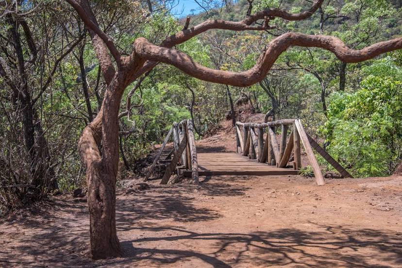
Photo
Where is located Municipal Park of Mangabeiras (Parque Municipal das Mangabeiras)
Municipal Park of Mangabeiras (Parque Municipal das Mangabeiras) — local attraction, which is located at Av. José do Patrocínio Pontes, 580 - Mangabeiras, Belo Horizonte - MG, 30210-090, Brazil and belongs to the category — city park. Average visitor rating for this place — 4.6 (according to 7387 ratings, information from open sources and relevant for 2022).
Exact location — Municipal Park of Mangabeiras (Parque Municipal das Mangabeiras), marked on the map with a red marker.
You can get directions to Municipal Park of Mangabeiras (Parque Municipal das Mangabeiras) on the map from your location.
What else is interesting in Raposos? You can see all the sights if you go to the city page.
Coordinates
Municipal Park of Mangabeiras (Parque Municipal das Mangabeiras), Brazil coordinates in decimal format: latitude — -19.951546668681686, longitude — -43.90552977553564. When converted to degrees, minutes, seconds Municipal Park of Mangabeiras (Parque Municipal das Mangabeiras) has the following coordinates: -19°57′5.57 north latitude and -43°54′19.91 east longitude.
Nearby cities
The largest cities that are located nearby:
- Sabará — 9 km
- Belo Horizonte — 14 km
- Santa Luzia — 24 km
- Ibirité — 27 km
- Contagem — 29 km
- Ribeirão das Neves — 36 km
- Betim — 41 km
- Esmeraldas — 43 km
- Sete Lagoas — 72 km
- Divinópolis — 114 km
- Coronel Fabriciano — 132 km
- Barbacena — 139 km
- Juiz de Fora — 204 km
- Valadares Governor — 229 km
- Volta Redonda — 283 km
- Teresópolis — 284 km
- Resende — 285 km
- Barra Mansa — 287 km
- Petrópolis — 289 km