
 Puerto de la Duquesa
La Serna de Iguña
Pumalverde
Puentenansa
La Iglesia
Casar de Periedo
Fuengirola
Renedo de Piélagos
Villabanez
Puerto de la Duquesa
La Serna de Iguña
Pumalverde
Puentenansa
La Iglesia
Casar de Periedo
Fuengirola
Renedo de Piélagos
Villabanez
Cala Salada on the map, Sant Antoni de Portmany, Spain
Photo
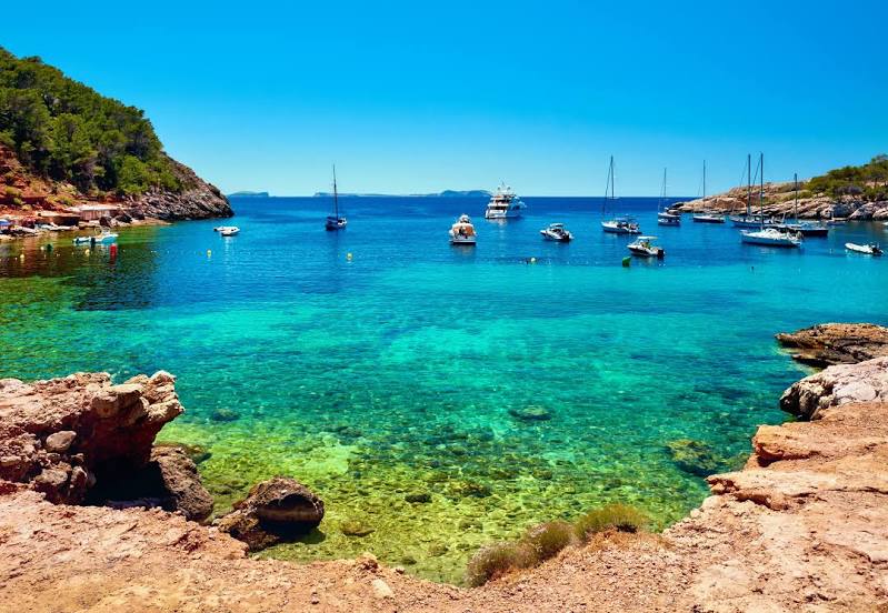
Where is located Cala Salada
Cala Salada — local attraction, which is located at no data and belongs to the category — -. Average visitor rating for this place — 4.5 (according to 390 ratings, information from open sources and relevant for 2022).
Exact location — Cala Salada, marked on the map with a red marker.
You can get directions to Cala Salada on the map from your location.
What else is interesting in Sant Antoni de Portmany? You can see all the sights if you go to the city page.
Coordinates
Cala Salada, Spain coordinates in decimal format: latitude — 39.00921881778461, longitude — 1.295093982218295. When converted to degrees, minutes, seconds Cala Salada has the following coordinates: 39°0′33.19 north latitude and 1°17′42.34 east longitude.
Nearby cities
The largest cities that are located nearby:
- Palma — 132 km
- Valencia — 153 km
- Tarragona — 236 km
- Murcia — 239 km
- Cartagena — 251 km
- Albacete — 272 km
- L'Hospitalet de Llobregat — 272 km
- Santa Coloma de Gramenet — 282 km
- Badalona — 283 km
- Sidi M'Hamed
 (Algeria) — 290 km
 - Sabadell — 291 km
- Terrassa — 291 km
- Lleida — 297 km
- Mataró — 298 km
- Chlef (Algeria) — 311 km
- Médéa (Algeria) — 327 km
- Zaragoza — 346 km
- Relizane (Algeria) — 366 km
- Oran (Algeria) — 403 km
Distance to the capital
Distance to the capital (Madrid) is about — 455 km.