
 Gilserberg
Berlin
Bordesholm
Bechtolsheim
Aub
Triptis
Heppenheim
Biblis
Angermünde
Gilserberg
Berlin
Bordesholm
Bechtolsheim
Aub
Triptis
Heppenheim
Biblis
Angermünde
Mauerpark on the map, Pankow, Germany
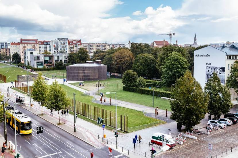
Photo
Where is located Mauerpark
Mauerpark — local attraction, which is located at Gleimstraße 55, 10437 Berlin, Germany and belongs to the category — state park. Average visitor rating for this place — 4.4 (according to 11415 ratings, information from open sources and relevant for 2022).
Exact location — Mauerpark, marked on the map with a red marker.
You can get directions to Mauerpark on the map from your location.
What else is interesting in Pankow? You can see all the sights if you go to the city page.
Coordinates
Mauerpark, Germany coordinates in decimal format: latitude — 52.54237061730503, longitude — 13.403287625357686. When converted to degrees, minutes, seconds Mauerpark has the following coordinates: 52°32′32.53 north latitude and 13°24′11.84 east longitude.
Nearby cities
The largest cities that are located nearby:
- Berlin — 10 km
- Potsdam — 33 km
- Cottbus — 110 km
- Szczecin
 (Poland) — 119 km
 - Gorzów Wielkopolski (Poland) — 122 km
- Magdeburg — 133 km
- Leipzig — 156 km
- Zielona Gora (Poland) — 159 km
- Dresden — 171 km
- Wolfsburg — 179 km
- Rostock — 188 km
- Chemnitz — 197 km
- Brunswick — 200 km
- Gera — 210 km
- Salzgitter — 216 km
- Poznań (Poland) — 236 km
- Hildesheim — 240 km
- Legnica (Poland) — 242 km
- Erfurt — 243 km
Distance to the capital
Distance to the capital (Berlin) is about — 2 km.