
 Litoral Del Bajo San Juan
El Cantón de San Pablo
Juan Frío
Santa Barbara
El Juncal
Dibulla
Vereda Campo Alegre
San Pablo
Guaramito
Litoral Del Bajo San Juan
El Cantón de San Pablo
Juan Frío
Santa Barbara
El Juncal
Dibulla
Vereda Campo Alegre
San Pablo
Guaramito
Fuerte Ecologico Parque Nacional del Fique on the map, Copacabana, Colombia
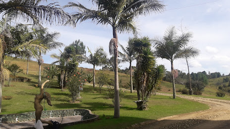
Photo
Where is located Fuerte Ecologico Parque Nacional del Fique
Fuerte Ecologico Parque Nacional del Fique — local attraction, which is located at Unnamed Rd,, El Socorro, Guarne, Antioquia, Colombia and belongs to the category — park. Average visitor rating for this place — 4.7 (according to 167 ratings, information from open sources and relevant for 2022).
Exact location — Fuerte Ecologico Parque Nacional del Fique, marked on the map with a red marker.
You can get directions to Fuerte Ecologico Parque Nacional del Fique on the map from your location.
What else is interesting in Copacabana? You can see all the sights if you go to the city page.
Coordinates
Fuerte Ecologico Parque Nacional del Fique, Colombia coordinates in decimal format: latitude — 6.269535404456405, longitude — -75.48430327568123. When converted to degrees, minutes, seconds Fuerte Ecologico Parque Nacional del Fique has the following coordinates: 6°16′10.33 north latitude and -75°29′3.49 east longitude.
Nearby cities
The largest cities that are located nearby:
- Bello — 6 km
- Medellín — 11 km
- Envigado — 21 km
- Itagüi — 23 km
- Manizales — 141 km
- Dos Quebradas — 168 km
- Pereira — 171 km
- Cartago — 182 km
- Barrancabermeja — 198 km
- Armenia — 201 km
- Ibagué — 213 km
- Girardot — 239 km
- Soacha — 241 km
- Tunja — 254 km
- Tuluá — 261 km
- Giron — 268 km
- Monteria — 269 km
- Bucaramanga — 275 km
- Floridablanca — 277 km
Distance to the capital
Distance to the capital (Bogota) is about — 243 km.