
 زفتى
Qesm Hurghada
Gazirat Muhammad
Qesm Nakhl
Om Sabir Village
6th of October City
Cairo Governorate
Qism Sidi Gabir
Ezbet Hussein Salamah
زفتى
Qesm Hurghada
Gazirat Muhammad
Qesm Nakhl
Om Sabir Village
6th of October City
Cairo Governorate
Qism Sidi Gabir
Ezbet Hussein Salamah
Pataya beach club on the map, Sharm El-Sheikh, Egypt
Photo
Where is located Pataya beach club
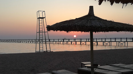
Pataya beach club — local attraction, which is located at Nabq bay, Egypt and belongs to the category — beach. Average visitor rating for this place — 4.4 (according to 684 ratings, information from open sources and relevant for 2022).
Exact location — Pataya beach club, marked on the map with a red marker.
You can get directions to Pataya beach club on the map from your location.
What else is interesting in Sharm El-Sheikh? You can see all the sights if you go to the city page.
Coordinates
Pataya beach club, Egypt coordinates in decimal format: latitude — 28.04131257051839, longitude — 34.43600842461879. When converted to degrees, minutes, seconds Pataya beach club has the following coordinates: 28°2′28.73 north latitude and 34°26′9.63 east longitude.
Nearby cities
The largest cities that are located nearby:
- Tabuk
 (Saudi Arabia) — 225 km
 - Qena — 252 km
- Suez — 284 km
- Luxor — 298 km
- Sohag — 301 km
- Asyut — 320 km
- Beni Suef — 337 km
- Mallawi — 342 km
- Ismailia — 355 km
- Qalyub — 389 km
- Zagazig — 399 km
- Banha — 411 km
- Ashqelon
 (Israel) — 416 km
 - Port Said — 417 km
- Ashdod (Israel) — 431 km
- Jerusalem (Israel) — 434 km
- Talkha — 446 km
- Aswan — 447 km
- Bat Yam (Israel) — 455 km
Distance to the capital
Distance to the capital (Cairo) is about — 383 km.