 Warner Robins
Wantagh
Bethel
Misty Hill Farm
United States
Wakonda Beach (R33) Airport
Wilmington
Poland
Miami International Airport
Warner Robins
Wantagh
Bethel
Misty Hill Farm
United States
Wakonda Beach (R33) Airport
Wilmington
Poland
Miami International Airport
Bicentennial Capitol Mall State Park on the map, Nashville, United States
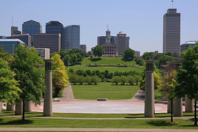
Photo
Where is located Bicentennial Capitol Mall State Park
Bicentennial Capitol Mall State Park — local attraction, which is located at 600 James Robertson Pkwy, Nashville, TN 37243, United States and belongs to the category — state park. Average visitor rating for this place — 4.7 (according to 2888 ratings, information from open sources and relevant for 2022).
Exact location — Bicentennial Capitol Mall State Park, marked on the map with a red marker.
You can get directions to Bicentennial Capitol Mall State Park on the map from your location.
What else is interesting in Nashville? You can see all the sights if you go to the city page.
Coordinates
Bicentennial Capitol Mall State Park, United States coordinates in decimal format: latitude — 36.17084850573869, longitude — -86.7876533751783. When converted to degrees, minutes, seconds Bicentennial Capitol Mall State Park has the following coordinates: 36°10′15.05 north latitude and -86°47′15.55 east longitude.
Nearby cities
The largest cities that are located nearby:
- Clarksville — 65 km
- Huntsville — 159 km
- Chattanooga — 182 km
- Evansville — 211 km
- Louisville — 248 km
- Knoxville — 257 km
- Birmingham — 292 km
- Memphis — 316 km
- Atlanta — 346 km
- Cincinnati — 379 km
- Saint Louis — 402 km
- Indianapolis — 402 km
- Montgomery — 422 km
- Springfield — 486 km
- Little Rock — 524 km
- Columbus — 528 km
- Jackson — 533 km
- Charlotte — 546 km
- Peoria — 553 km
Distance to the capital
Distance to the capital (Washington) is about — 912 km.