 Warner Robins
Wantagh
Bethel
Misty Hill Farm
United States
Wakonda Beach (R33) Airport
Wilmington
Poland
Miami International Airport
Warner Robins
Wantagh
Bethel
Misty Hill Farm
United States
Wakonda Beach (R33) Airport
Wilmington
Poland
Miami International Airport
Castle Museum of Saginaw County History on the map, Saginaw, United States
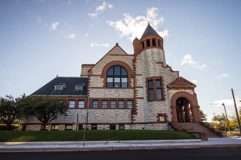
Photo
Where is located Castle Museum of Saginaw County History
Castle Museum of Saginaw County History — local attraction, which is located at 500 Federal Ave, Saginaw, MI 48607, United States and belongs to the category — museum. Average visitor rating for this place — 4.7 (according to 358 ratings, information from open sources and relevant for 2022).
Exact location — Castle Museum of Saginaw County History, marked on the map with a red marker.
You can get directions to Castle Museum of Saginaw County History on the map from your location.
What else is interesting in Saginaw? You can see all the sights if you go to the city page.
Coordinates
Castle Museum of Saginaw County History, United States coordinates in decimal format: latitude — 43.43095291821384, longitude — -83.93561237496006. When converted to degrees, minutes, seconds Castle Museum of Saginaw County History has the following coordinates: 43°25′51.43 north latitude and -83°56′8.2 east longitude.
Nearby cities
The largest cities that are located nearby:
- Flint — 50 km
- Lansing — 90 km
- Sterling Heights — 119 km
- Warren — 126 km
- Ann Arbor — 127 km
- Detroit — 141 km
- Windsor
 (Canada) — 143 km
 - Grand Rapids — 148 km
- Toledo — 197 km
- London (Canada) — 224 km
- South Bend — 271 km
- Waterloo (Canada) — 275 km
- Fort Wayne — 277 km
- Kitchener (Canada) — 279 km
- Cleveland — 283 km
- Cambridge (Canada) — 292 km
- Guelph (Canada) — 297 km
- Aurora — 318 km
- Milwaukee — 322 km
Distance to the capital
Distance to the capital (Washington) is about — 766 km.