 Warner Robins
Wantagh
Bethel
Misty Hill Farm
United States
Wakonda Beach (R33) Airport
Wilmington
Poland
Miami International Airport
Warner Robins
Wantagh
Bethel
Misty Hill Farm
United States
Wakonda Beach (R33) Airport
Wilmington
Poland
Miami International Airport
Virginia State Capitol on the map, Richmond, United States
Photo
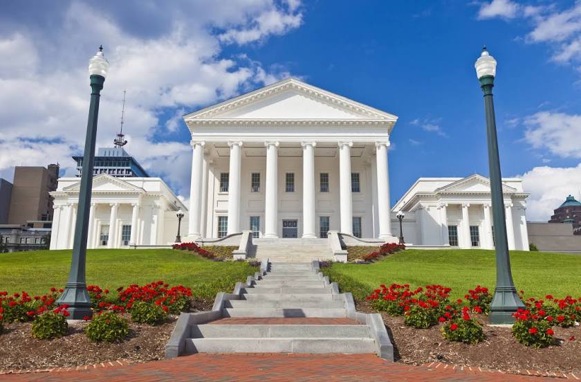
Where is located Virginia State Capitol
Virginia State Capitol — local attraction, which is located at 1000 Bank St, Richmond, VA 23218, United States and belongs to the category — historical landmark. Average visitor rating for this place — 4.6 (according to 696 ratings, information from open sources and relevant for 2022).
Exact location — Virginia State Capitol, marked on the map with a red marker.
You can get directions to Virginia State Capitol on the map from your location.
What else is interesting in Richmond? You can see all the sights if you go to the city page.
Coordinates
Virginia State Capitol, United States coordinates in decimal format: latitude — 37.53877349680123, longitude — -77.4336592751398. When converted to degrees, minutes, seconds Virginia State Capitol has the following coordinates: 37°32′19.58 north latitude and -77°26′1.17 east longitude.
Nearby cities
The largest cities that are located nearby:
- Hampton — 112 km
- Norfolk — 127 km
- Chesapeake — 133 km
- Alexandria — 144 km
- Virginia Beach — 150 km
- Baltimore — 206 km
- Durham — 215 km
- Raleigh — 223 km
- Cary — 228 km
- Greensboro — 266 km
- Winston-Salem — 297 km
- Fayetteville — 304 km
- Philadelphia — 329 km
- Allentown — 376 km
- Toms River — 383 km
- Pittsburgh — 386 km
- Charlotte — 400 km
- Edison — 416 km
- Elizabeth — 439 km
Distance to the capital
Distance to the capital (Washington) is about — 156 km.