 Warner Robins
Wantagh
Bethel
Misty Hill Farm
United States
Wakonda Beach (R33) Airport
Wilmington
Poland
Miami International Airport
Warner Robins
Wantagh
Bethel
Misty Hill Farm
United States
Wakonda Beach (R33) Airport
Wilmington
Poland
Miami International Airport
Seneca Regional Park on the map, Reston, United States
Photo
Where is located Seneca Regional Park
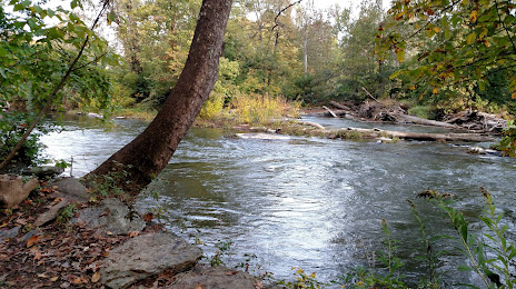
Seneca Regional Park — local attraction, which is located at 101 Seneca Rd, Great Falls, VA 22066, United States and belongs to the category — park. Average visitor rating for this place — 4.7 (according to 290 ratings, information from open sources and relevant for 2022).
Exact location — Seneca Regional Park, marked on the map with a red marker.
You can get directions to Seneca Regional Park on the map from your location.
What else is interesting in Reston? You can see all the sights if you go to the city page.
Coordinates
Seneca Regional Park, United States coordinates in decimal format: latitude — 39.05159398651059, longitude — -77.33415267509565. When converted to degrees, minutes, seconds Seneca Regional Park has the following coordinates: 39°3′5.74 north latitude and -77°20′2.95 east longitude.
Nearby cities
The largest cities that are located nearby:
- Alexandria — 32 km
- Baltimore — 74 km
- Richmond — 157 km
- Philadelphia — 216 km
- Hampton — 231 km
- Allentown — 240 km
- Norfolk — 252 km
- Chesapeake — 260 km
- Virginia Beach — 263 km
- Pittsburgh — 276 km
- Toms River — 289 km
- Edison — 302 km
- Elizabeth — 324 km
- Newark — 331 km
- Brooklyn — 341 km
- New York — 341 km
- Paterson — 343 km
- Durham — 356 km
- Yonkers — 362 km
Distance to the capital
Distance to the capital (Washington) is about — 30 km.