 Warner Robins
Wantagh
Bethel
Misty Hill Farm
United States
Wakonda Beach (R33) Airport
Wilmington
Poland
Miami International Airport
Warner Robins
Wantagh
Bethel
Misty Hill Farm
United States
Wakonda Beach (R33) Airport
Wilmington
Poland
Miami International Airport
Freeman Kame - Meagher Forest Preserve on the map, Huntley, United States
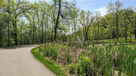
Photo
Where is located Freeman Kame - Meagher Forest Preserve
Freeman Kame - Meagher Forest Preserve — local attraction, which is located at Huntley, IL 60142, United States and belongs to the category — nature preserve. Average visitor rating for this place — 4.5 (according to 70 ratings, information from open sources and relevant for 2022).
Exact location — Freeman Kame - Meagher Forest Preserve, marked on the map with a red marker.
You can get directions to Freeman Kame - Meagher Forest Preserve on the map from your location.
What else is interesting in Huntley? You can see all the sights if you go to the city page.
Coordinates
Freeman Kame - Meagher Forest Preserve, United States coordinates in decimal format: latitude — 42.12858917295191, longitude — -88.39729177500158. When converted to degrees, minutes, seconds Freeman Kame - Meagher Forest Preserve has the following coordinates: 42°7′42.92 north latitude and -88°23′50.25 east longitude.
Nearby cities
The largest cities that are located nearby:
- Aurora — 46 km
- Naperville — 51 km
- Rockford — 56 km
- Chicago — 73 km
- Joliet — 77 km
- Milwaukee — 105 km
- Madison — 127 km
- South Bend — 188 km
- Peoria — 190 km
- Grand Rapids — 240 km
- Green Bay — 262 km
- Fort Wayne — 299 km
- Lansing — 321 km
- Indianapolis — 328 km
- Ann Arbor — 383 km
- Flint — 394 km
- Toledo — 406 km
- Saint Louis — 420 km
- Des Moines — 433 km
Distance to the capital
Distance to the capital (Washington) is about — 1024 km.