 Warner Robins
Wantagh
Bethel
Misty Hill Farm
United States
Wakonda Beach (R33) Airport
Wilmington
Poland
Miami International Airport
Warner Robins
Wantagh
Bethel
Misty Hill Farm
United States
Wakonda Beach (R33) Airport
Wilmington
Poland
Miami International Airport
N.P. Dodge Park on the map, Omaha, United States
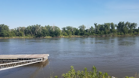
Photo
Where is located N.P. Dodge Park
N.P. Dodge Park — local attraction, which is located at 11001 John J Pershing Dr, Omaha, NE 68112, United States and belongs to the category — sports venue. Average visitor rating for this place — 4.3 (according to 269 ratings, information from open sources and relevant for 2022).
Exact location — N.P. Dodge Park, marked on the map with a red marker.
You can get directions to N.P. Dodge Park on the map from your location.
What else is interesting in Omaha? You can see all the sights if you go to the city page.
Coordinates
N.P. Dodge Park, United States coordinates in decimal format: latitude — 41.360878342301284, longitude — -95.96031007502559. When converted to degrees, minutes, seconds N.P. Dodge Park has the following coordinates: 41°21′39.16 north latitude and -95°57′37.12 east longitude.
Nearby cities
The largest cities that are located nearby:
- Lincoln — 74 km
- Des Moines — 201 km
- Topeka — 244 km
- Sioux Falls — 260 km
- North Kansas City — 263 km
- Kansas City — 267 km
- Independence — 275 km
- Overland Park — 276 km
- Olathe — 281 km
- Wichita — 411 km
- Minneapolis — 464 km
- Saint Paul — 468 km
- Springfield — 507 km
- Peoria — 541 km
- Tulsa — 564 km
- Madison — 570 km
- Rockford — 576 km
- Saint Louis — 579 km
- Aurora — 636 km
Distance to the capital
Distance to the capital (Washington) is about — 1629 km.