 Warner Robins
Wantagh
Bethel
Misty Hill Farm
United States
Wakonda Beach (R33) Airport
Wilmington
Poland
Miami International Airport
Warner Robins
Wantagh
Bethel
Misty Hill Farm
United States
Wakonda Beach (R33) Airport
Wilmington
Poland
Miami International Airport
The People's Winery on the map, Logansport, United States
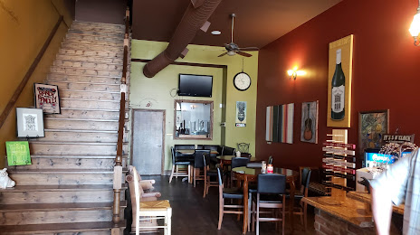
Photo
Where is located The People's Winery
The People's Winery — local attraction, which is located at 414 S 3rd St, Logansport, IN 46947, United States and belongs to the category — winery. Average visitor rating for this place — 4.6 (according to 22 ratings, information from open sources and relevant for 2022).
Exact location — The People's Winery, marked on the map with a red marker.
You can get directions to The People's Winery on the map from your location.
What else is interesting in Logansport? You can see all the sights if you go to the city page.
Coordinates
The People's Winery, United States coordinates in decimal format: latitude — 40.75231880555643, longitude — -86.3665170750444. When converted to degrees, minutes, seconds The People's Winery has the following coordinates: 40°45′8.35 north latitude and -86°21′59.46 east longitude.
Nearby cities
The largest cities that are located nearby:
- South Bend — 102 km
- Fort Wayne — 108 km
- Indianapolis — 110 km
- Chicago — 163 km
- Joliet — 166 km
- Naperville — 185 km
- Aurora — 196 km
- Springfield — 235 km
- Cincinnati — 242 km
- Grand Rapids — 250 km
- Toledo — 252 km
- Lansing — 263 km
- Peoria — 271 km
- Ann Arbor — 272 km
- Rockford — 280 km
- Louisville — 281 km
- Milwaukee — 282 km
- Columbus — 298 km
- Windsor
 (Canada) — 322 km
Distance to the capital
Distance to the capital (Washington) is about — 822 km.