 Warner Robins
Wantagh
Bethel
Misty Hill Farm
United States
Wakonda Beach (R33) Airport
Wilmington
Poland
Miami International Airport
Warner Robins
Wantagh
Bethel
Misty Hill Farm
United States
Wakonda Beach (R33) Airport
Wilmington
Poland
Miami International Airport
Bill Peavy Memorial Park on the map, Warner Robins, United States
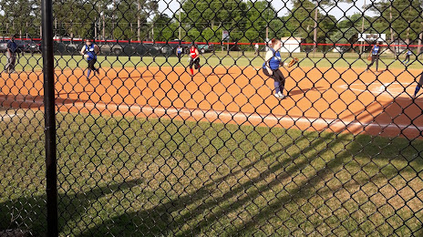
Photo
Where is located Bill Peavy Memorial Park
Bill Peavy Memorial Park — local attraction, which is located at 610 Johnson Rd, Warner Robins, GA 31093, United States and belongs to the category — park. Average visitor rating for this place — 4.3 (according to 186 ratings, information from open sources and relevant for 2022).
Exact location — Bill Peavy Memorial Park, marked on the map with a red marker.
You can get directions to Bill Peavy Memorial Park on the map from your location.
What else is interesting in Warner Robins? You can see all the sights if you go to the city page.
Coordinates
Bill Peavy Memorial Park, United States coordinates in decimal format: latitude — 32.64010422583901, longitude — -83.64621247527202. When converted to degrees, minutes, seconds Bill Peavy Memorial Park has the following coordinates: 32°38′24.38 north latitude and -83°38′46.36 east longitude.
Nearby cities
The largest cities that are located nearby:
- Atlanta — 144 km
- Savannah — 244 km
- Tallahassee — 248 km
- Montgomery — 251 km
- Columbia — 283 km
- Chattanooga — 309 km
- Birmingham — 310 km
- Jacksonville — 314 km
- Charleston — 344 km
- Gainesville — 350 km
- Huntsville — 357 km
- Knoxville — 371 km
- Charlotte — 383 km
- Mobile — 470 km
- Nashville — 483 km
- Winston-Salem — 490 km
- Orlando — 500 km
- Fayetteville — 507 km
- Greensboro — 513 km
Distance to the capital
Distance to the capital (Washington) is about — 917 km.