 Warner Robins
Wantagh
Bethel
Misty Hill Farm
United States
Wakonda Beach (R33) Airport
Wilmington
Poland
Miami International Airport
Warner Robins
Wantagh
Bethel
Misty Hill Farm
United States
Wakonda Beach (R33) Airport
Wilmington
Poland
Miami International Airport
Maxwell Park on the map, Normal, United States
Photo
Where is located Maxwell Park
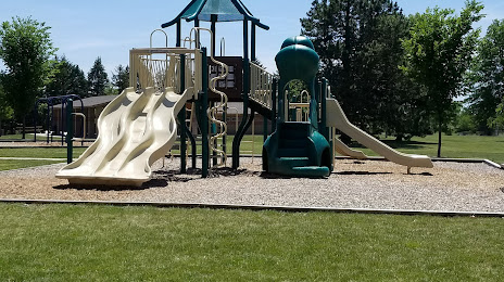
Maxwell Park — local attraction, which is located at 305 N Parkside Rd, Normal, IL 61761, United States and belongs to the category — park. Average visitor rating for this place — 4.5 (according to 243 ratings, information from open sources and relevant for 2022).
Exact location — Maxwell Park, marked on the map with a red marker.
You can get directions to Maxwell Park on the map from your location.
What else is interesting in Normal? You can see all the sights if you go to the city page.
Coordinates
Maxwell Park, United States coordinates in decimal format: latitude — 40.515843175816784, longitude — -89.02673967505164. When converted to degrees, minutes, seconds Maxwell Park has the following coordinates: 40°30′57.04 north latitude and -89°1′36.26 east longitude.
Nearby cities
The largest cities that are located nearby:
- Peoria — 54 km
- Joliet — 135 km
- Aurora — 148 km
- Naperville — 153 km
- Chicago — 188 km
- Rockford — 194 km
- Saint Louis — 233 km
- Indianapolis — 254 km
- South Bend — 260 km
- Madison — 285 km
- Milwaukee — 293 km
- Evansville — 307 km
- Fort Wayne — 327 km
- Louisville — 376 km
- Grand Rapids — 382 km
- Des Moines — 400 km
- Cincinnati — 415 km
- Lansing — 436 km
- Springfield — 444 km
Distance to the capital
Distance to the capital (Washington) is about — 1041 km.