 Warner Robins
Wantagh
Bethel
Misty Hill Farm
United States
Wakonda Beach (R33) Airport
Wilmington
Poland
Miami International Airport
Warner Robins
Wantagh
Bethel
Misty Hill Farm
United States
Wakonda Beach (R33) Airport
Wilmington
Poland
Miami International Airport
Catherine Chevalier Woods on the map, Melrose Park, United States
Photo
Where is located Catherine Chevalier Woods
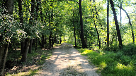
Catherine Chevalier Woods — local attraction, which is located at N East River Rd, Chicago, IL 60634, United States and belongs to the category — nature preserve. Average visitor rating for this place — 4.6 (according to 698 ratings, information from open sources and relevant for 2022).
Exact location — Catherine Chevalier Woods, marked on the map with a red marker.
You can get directions to Catherine Chevalier Woods on the map from your location.
What else is interesting in Melrose Park? You can see all the sights if you go to the city page.
Coordinates
Catherine Chevalier Woods, United States coordinates in decimal format: latitude — 41.97984818900939, longitude — -87.84749177500626. When converted to degrees, minutes, seconds Catherine Chevalier Woods has the following coordinates: 41°58′47.45 north latitude and -87°50′50.97 east longitude.
Nearby cities
The largest cities that are located nearby:
- Chicago — 19 km
- Naperville — 30 km
- Aurora — 41 km
- Joliet — 46 km
- Rockford — 109 km
- Milwaukee — 126 km
- South Bend — 135 km
- Madison — 180 km
- Peoria — 197 km
- Grand Rapids — 213 km
- Fort Wayne — 244 km
- Indianapolis — 276 km
- Lansing — 283 km
- Green Bay — 290 km
- Ann Arbor — 339 km
- Toledo — 356 km
- Flint — 359 km
- Detroit — 396 km
- Windsor
 (Canada) — 397 km
Distance to the capital
Distance to the capital (Washington) is about — 976 km.