 Warner Robins
Wantagh
Bethel
Misty Hill Farm
United States
Wakonda Beach (R33) Airport
Wilmington
Poland
Miami International Airport
Warner Robins
Wantagh
Bethel
Misty Hill Farm
United States
Wakonda Beach (R33) Airport
Wilmington
Poland
Miami International Airport
Illinois Aviation Museum on the map, Bolingbrook, United States
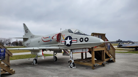
Photo
Where is located Illinois Aviation Museum
Illinois Aviation Museum — local attraction, which is located at S, 110 Clow International Pkwy, Bolingbrook, IL 60490, United States and belongs to the category — museum. Average visitor rating for this place — 4.8 (according to 106 ratings, information from open sources and relevant for 2022).
Exact location — Illinois Aviation Museum, marked on the map with a red marker.
You can get directions to Illinois Aviation Museum on the map from your location.
What else is interesting in Bolingbrook? You can see all the sights if you go to the city page.
Coordinates
Illinois Aviation Museum, United States coordinates in decimal format: latitude — 41.67500765349868, longitude — -88.27878875530118. When converted to degrees, minutes, seconds Illinois Aviation Museum has the following coordinates: 41°40′30.03 north latitude and -88°16′43.64 east longitude.
Nearby cities
The largest cities that are located nearby:
- Naperville — 9 km
- Joliet — 19 km
- Aurora — 22 km
- Chicago — 41 km
- Rockford — 105 km
- Milwaukee — 149 km
- South Bend — 150 km
- Peoria — 169 km
- Madison — 186 km
- Grand Rapids — 239 km
- Fort Wayne — 254 km
- Indianapolis — 268 km
- Lansing — 307 km
- Green Bay — 312 km
- Ann Arbor — 360 km
- Toledo — 373 km
- Flint — 383 km
- Saint Louis — 386 km
- Springfield — 411 km
Distance to the capital
Distance to the capital (Washington) is about — 1001 km.