 Warner Robins
Wantagh
Bethel
Misty Hill Farm
United States
Wakonda Beach (R33) Airport
Wilmington
Poland
Miami International Airport
Warner Robins
Wantagh
Bethel
Misty Hill Farm
United States
Wakonda Beach (R33) Airport
Wilmington
Poland
Miami International Airport
Rivers of Steel: Carrie Blast Furnaces National Historic Landmark on the map, West Mifflin, United States
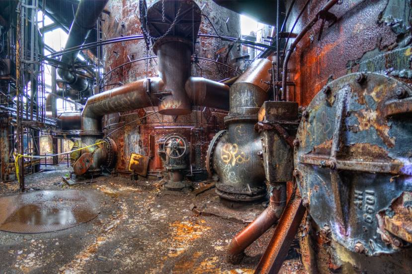
Photo
Where is located Rivers of Steel: Carrie Blast Furnaces National Historic Landmark
Rivers of Steel: Carrie Blast Furnaces National Historic Landmark — local attraction, which is located at 801 Carrie Furnace Blvd, Pittsburgh, PA 15218, United States and belongs to the category — historical landmark. Average visitor rating for this place — 4.8 (according to 427 ratings, information from open sources and relevant for 2022).
Exact location — Rivers of Steel: Carrie Blast Furnaces National Historic Landmark, marked on the map with a red marker.
You can get directions to Rivers of Steel: Carrie Blast Furnaces National Historic Landmark on the map from your location.
What else is interesting in West Mifflin? You can see all the sights if you go to the city page.
Coordinates
Rivers of Steel: Carrie Blast Furnaces National Historic Landmark, United States coordinates in decimal format: latitude — 40.41390462008254, longitude — -79.88985847505475. When converted to degrees, minutes, seconds Rivers of Steel: Carrie Blast Furnaces National Historic Landmark has the following coordinates: 40°24′50.06 north latitude and -79°53′23.49 east longitude.
Nearby cities
The largest cities that are located nearby:
- Pittsburgh — 14 km
- Akron — 159 km
- Aurora — 162 km
- Cleveland — 197 km
- Boston — 267 km
- Columbus — 269 km
- Buffalo — 290 km
- Alexandria — 298 km
- Amherst — 302 km
- Baltimore — 303 km
- London
 (Canada) — 311 km
 - Saint Catharines (Canada) — 313 km
- Hamilton (Canada) — 319 km
- Burlington (Canada) — 328 km
- Cambridge (Canada) — 333 km
- Toledo — 337 km
- Windsor (Canada) — 337 km
- Springfield — 338 km
- Detroit — 339 km
Distance to the capital
Distance to the capital (Washington) is about — 296 km.