 Warner Robins
Wantagh
Bethel
Misty Hill Farm
United States
Wakonda Beach (R33) Airport
Wilmington
Poland
Miami International Airport
Warner Robins
Wantagh
Bethel
Misty Hill Farm
United States
Wakonda Beach (R33) Airport
Wilmington
Poland
Miami International Airport
Cannon Branch Fort on the map, Manassas, United States
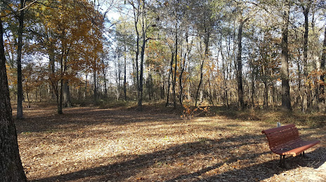
Photo
Where is located Cannon Branch Fort
Cannon Branch Fort — local attraction, which is located at 10611 Gateway Blvd, Manassas, VA 20110, United States and belongs to the category — park. Average visitor rating for this place — 4.0 (according to 27 ratings, information from open sources and relevant for 2022).
Exact location — Cannon Branch Fort, marked on the map with a red marker.
You can get directions to Cannon Branch Fort on the map from your location.
What else is interesting in Manassas? You can see all the sights if you go to the city page.
Coordinates
Cannon Branch Fort, United States coordinates in decimal format: latitude — 38.74232234119996, longitude — -77.51351266828878. When converted to degrees, minutes, seconds Cannon Branch Fort has the following coordinates: 38°44′32.36 north latitude and -77°30′48.65 east longitude.
Nearby cities
The largest cities that are located nearby:
- Alexandria — 37 km
- Baltimore — 95 km
- Richmond — 134 km
- Hampton — 215 km
- Norfolk — 235 km
- Philadelphia — 237 km
- Chesapeake — 243 km
- Virginia Beach — 248 km
- Allentown — 264 km
- Pittsburgh — 283 km
- Toms River — 308 km
- Edison — 323 km
- Durham — 330 km
- Raleigh — 345 km
- Elizabeth — 346 km
- Cary — 348 km
- Newark — 353 km
- Greensboro — 361 km
- Brooklyn — 362 km
Distance to the capital
Distance to the capital (Washington) is about — 45 km.