 Warner Robins
Wantagh
Bethel
Misty Hill Farm
United States
Wakonda Beach (R33) Airport
Wilmington
Poland
Miami International Airport
Warner Robins
Wantagh
Bethel
Misty Hill Farm
United States
Wakonda Beach (R33) Airport
Wilmington
Poland
Miami International Airport
Difficult Run Stream Valley Park on the map, Herndon, United States
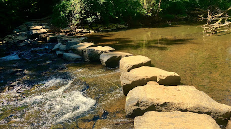
Photo
Where is located Difficult Run Stream Valley Park
Difficult Run Stream Valley Park — local attraction, which is located at 1105 Hobnail Ct, Great Falls, VA 22066, United States and belongs to the category — park. Average visitor rating for this place — 4.5 (according to 120 ratings, information from open sources and relevant for 2022).
Exact location — Difficult Run Stream Valley Park, marked on the map with a red marker.
You can get directions to Difficult Run Stream Valley Park on the map from your location.
What else is interesting in Herndon? You can see all the sights if you go to the city page.
Coordinates
Difficult Run Stream Valley Park, United States coordinates in decimal format: latitude — 38.94410923039509, longitude — -77.31095722549082. When converted to degrees, minutes, seconds Difficult Run Stream Valley Park has the following coordinates: 38°56′38.79 north latitude and -77°18′39.45 east longitude.
Nearby cities
The largest cities that are located nearby:
- Alexandria — 34 km
- Baltimore — 75 km
- Richmond — 158 km
- Philadelphia — 217 km
- Hampton — 233 km
- Allentown — 241 km
- Norfolk — 254 km
- Chesapeake — 262 km
- Virginia Beach — 265 km
- Pittsburgh — 273 km
- Toms River — 291 km
- Edison — 303 km
- Elizabeth — 326 km
- Newark — 333 km
- Brooklyn — 342 km
- New York — 343 km
- Paterson — 344 km
- Durham — 356 km
- Yonkers — 363 km
Distance to the capital
Distance to the capital (Washington) is about — 24 km.