 Warner Robins
Wantagh
Bethel
Misty Hill Farm
United States
Wakonda Beach (R33) Airport
Wilmington
Poland
Miami International Airport
Warner Robins
Wantagh
Bethel
Misty Hill Farm
United States
Wakonda Beach (R33) Airport
Wilmington
Poland
Miami International Airport
Colorado Springs Fine Arts Center at Colorado College on the map, Colorado Springs, United States
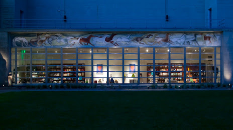
Photo
Where is located Colorado Springs Fine Arts Center at Colorado College
Colorado Springs Fine Arts Center at Colorado College — local attraction, which is located at 30 W Dale St, Colorado Springs, CO 80903, United States and belongs to the category — art center. Average visitor rating for this place — 4.5 (according to 142 ratings, information from open sources and relevant for 2022).
Exact location — Colorado Springs Fine Arts Center at Colorado College, marked on the map with a red marker.
You can get directions to Colorado Springs Fine Arts Center at Colorado College on the map from your location.
What else is interesting in Colorado Springs? You can see all the sights if you go to the city page.
Coordinates
Colorado Springs Fine Arts Center at Colorado College, United States coordinates in decimal format: latitude — 38.846167377726324, longitude — -104.82661337510177. When converted to degrees, minutes, seconds Colorado Springs Fine Arts Center at Colorado College has the following coordinates: 38°50′46.2 north latitude and -104°49′35.81 east longitude.
Nearby cities
The largest cities that are located nearby:
- Pueblo — 67 km
- Lakewood — 99 km
- Aurora — 99 km
- Denver — 101 km
- Arvada — 109 km
- Westminster — 112 km
- Thornton — 115 km
- Fort Collins — 195 km
- Albuquerque — 445 km
- Valencia — 478 km
- Amarillo — 482 km
- Provo — 598 km
- West Jordan — 629 km
- Salt Lake City — 629 km
- West Valley City — 636 km
- Lubbock — 642 km
- Wichita — 667 km
- Lincoln — 715 km
- Oklahoma City — 756 km
Distance to the capital
Distance to the capital (Washington) is about — 2397 km.