 Warner Robins
Wantagh
Bethel
Misty Hill Farm
United States
Wakonda Beach (R33) Airport
Wilmington
Poland
Miami International Airport
Warner Robins
Wantagh
Bethel
Misty Hill Farm
United States
Wakonda Beach (R33) Airport
Wilmington
Poland
Miami International Airport
Crescent City Connection on the map, New Orleans, United States
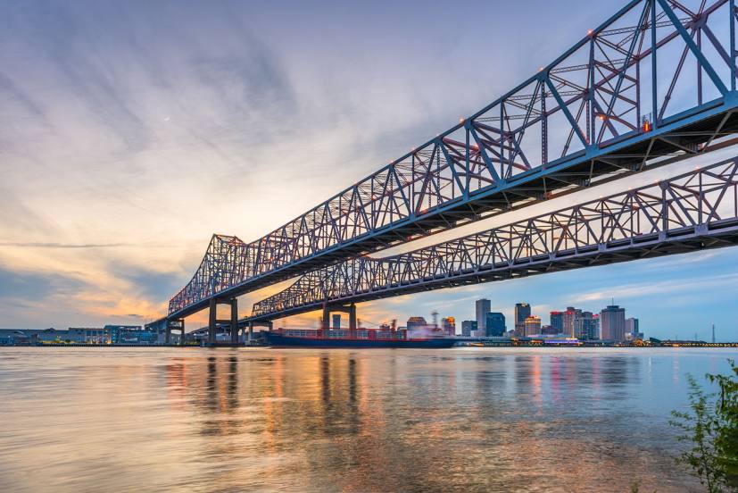
Photo
Where is located Crescent City Connection
Crescent City Connection — local attraction, which is located at New Orleans, LA 70114, United States and belongs to the category — bridge. Average visitor rating for this place — 4.4 (according to 163 ratings, information from open sources and relevant for 2022).
Exact location — Crescent City Connection, marked on the map with a red marker.
You can get directions to Crescent City Connection on the map from your location.
What else is interesting in New Orleans? You can see all the sights if you go to the city page.
Coordinates
Crescent City Connection, United States coordinates in decimal format: latitude — 29.938941844728458, longitude — -90.05583307533797. When converted to degrees, minutes, seconds Crescent City Connection has the following coordinates: 29°56′20.19 north latitude and -90°3′21 east longitude.
Nearby cities
The largest cities that are located nearby:
- Metairie — 9 km
- Baton Rouge — 116 km
- Lafayette — 189 km
- Mobile — 210 km
- Jackson — 260 km
- Beaumont — 388 km
- Montgomery — 442 km
- Shreveport — 446 km
- Birmingham — 497 km
- Houston — 509 km
- Tallahassee — 555 km
- Little Rock — 567 km
- Memphis — 575 km
- Huntsville — 616 km
- Atlanta — 670 km
- Mesquite — 682 km
- Waco — 690 km
- Garland — 692 km
- Dallas — 699 km
Distance to the capital
Distance to the capital (Washington) is about — 1553 km.