 Warner Robins
Wantagh
Bethel
Misty Hill Farm
United States
Wakonda Beach (R33) Airport
Wilmington
Poland
Miami International Airport
Warner Robins
Wantagh
Bethel
Misty Hill Farm
United States
Wakonda Beach (R33) Airport
Wilmington
Poland
Miami International Airport
City Park Lake on the map, Baton Rouge, United States
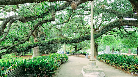
Photo
Where is located City Park Lake
City Park Lake — local attraction, which is located at no data and belongs to the category — -. Average visitor rating for this place — 3.9 (according to 12 ratings, information from open sources and relevant for 2022).
Exact location — City Park Lake, marked on the map with a red marker.
You can get directions to City Park Lake on the map from your location.
What else is interesting in Baton Rouge? You can see all the sights if you go to the city page.
Coordinates
City Park Lake, United States coordinates in decimal format: latitude — 30.42490011435232, longitude — -91.16627995529286. When converted to degrees, minutes, seconds City Park Lake has the following coordinates: 30°25′29.64 north latitude and -91°9′58.61 east longitude.
Nearby cities
The largest cities that are located nearby:
- Lafayette — 88 km
- Metairie — 108 km
- New Orleans — 117 km
- Jackson — 222 km
- Beaumont — 289 km
- Mobile — 296 km
- Shreveport — 334 km
- Houston — 413 km
- Little Rock — 485 km
- Montgomery — 499 km
- Birmingham — 524 km
- Memphis — 528 km
- Mesquite — 568 km
- Garland — 578 km
- Waco — 579 km
- Dallas — 585 km
- Richardson — 587 km
- Plano — 588 km
- Irving — 599 km
Distance to the capital
Distance to the capital (Washington) is about — 1597 km.