 Warner Robins
Wantagh
Bethel
Misty Hill Farm
United States
Wakonda Beach (R33) Airport
Wilmington
Poland
Miami International Airport
Warner Robins
Wantagh
Bethel
Misty Hill Farm
United States
Wakonda Beach (R33) Airport
Wilmington
Poland
Miami International Airport
Rotary Park on the map, Livonia, United States
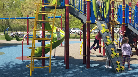
Photo
Where is located Rotary Park
Rotary Park — local attraction, which is located at Six Mile Rd & Hubbard St, Livonia, MI 48152, United States and belongs to the category — park. Average visitor rating for this place — 4.7 (according to 1225 ratings, information from open sources and relevant for 2022).
Exact location — Rotary Park, marked on the map with a red marker.
You can get directions to Rotary Park on the map from your location.
What else is interesting in Livonia? You can see all the sights if you go to the city page.
Coordinates
Rotary Park, United States coordinates in decimal format: latitude — 42.41343833438241, longitude — -83.3628849749926. When converted to degrees, minutes, seconds Rotary Park has the following coordinates: 42°24′48.38 north latitude and -83°21′46.39 east longitude.
Nearby cities
The largest cities that are located nearby:
- Detroit — 25 km
- Windsor
 (Canada) — 27 km
 - Warren — 32 km
- Ann Arbor — 33 km
- Sterling Heights — 35 km
- Flint — 76 km
- Toledo — 80 km
- Lansing — 106 km
- Cleveland — 168 km
- London (Canada) — 184 km
- Grand Rapids — 199 km
- Aurora — 203 km
- Fort Wayne — 206 km
- Akron — 209 km
- South Bend — 251 km
- Waterloo (Canada) — 258 km
- Kitchener (Canada) — 258 km
- Cambridge (Canada) — 268 km
- Columbus — 268 km
Distance to the capital
Distance to the capital (Washington) is about — 661 km.