 Warner Robins
Wantagh
Bethel
Misty Hill Farm
United States
Wakonda Beach (R33) Airport
Wilmington
Poland
Miami International Airport
Warner Robins
Wantagh
Bethel
Misty Hill Farm
United States
Wakonda Beach (R33) Airport
Wilmington
Poland
Miami International Airport
Haikey Creek Park on the map, Tulsa, United States
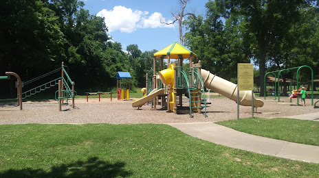
Photo
Where is located Haikey Creek Park
Haikey Creek Park — local attraction, which is located at 11327 S Garnett Rd, Broken Arrow, OK 74011, United States and belongs to the category — park. Average visitor rating for this place — 4.5 (according to 738 ratings, information from open sources and relevant for 2022).
Exact location — Haikey Creek Park, marked on the map with a red marker.
You can get directions to Haikey Creek Park on the map from your location.
What else is interesting in Tulsa? You can see all the sights if you go to the city page.
Coordinates
Haikey Creek Park, United States coordinates in decimal format: latitude — 36.023042848287176, longitude — -95.85343492500492. When converted to degrees, minutes, seconds Haikey Creek Park has the following coordinates: 36°1′22.95 north latitude and -95°51′12.37 east longitude.
Nearby cities
The largest cities that are located nearby:
- Oklahoma City — 157 km
- Norman — 166 km
- Wichita — 206 km
- Springfield — 265 km
- Olathe — 318 km
- Topeka — 322 km
- Overland Park — 333 km
- Wichita Falls — 338 km
- Frisco — 341 km
- Denton — 342 km
- Kansas City — 348 km
- Independence — 352 km
- North Kansas City — 352 km
- Plano — 353 km
- Richardson — 361 km
- Carrollton — 361 km
- Garland — 363 km
- Little Rock — 371 km
- Mesquite — 379 km
Distance to the capital
Distance to the capital (Washington) is about — 1689 km.