 Warner Robins
Wantagh
Bethel
Misty Hill Farm
United States
Wakonda Beach (R33) Airport
Wilmington
Poland
Miami International Airport
Warner Robins
Wantagh
Bethel
Misty Hill Farm
United States
Wakonda Beach (R33) Airport
Wilmington
Poland
Miami International Airport
John Paul Hammerschmidt Lake on the map, Fort Smith, United States
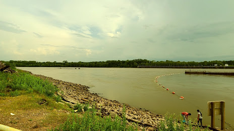
Photo
Where is located John Paul Hammerschmidt Lake
John Paul Hammerschmidt Lake — local attraction, which is located at 31.16 km² and belongs to the category — -. Average visitor rating for this place — 3.0 (according to 2 ratings, information from open sources and relevant for 2022).
Exact location — John Paul Hammerschmidt Lake, marked on the map with a red marker.
You can get directions to John Paul Hammerschmidt Lake on the map from your location.
What else is interesting in Fort Smith? You can see all the sights if you go to the city page.
Coordinates
John Paul Hammerschmidt Lake, United States coordinates in decimal format: latitude — 35.351796716500616, longitude — -94.29443822447249. When converted to degrees, minutes, seconds John Paul Hammerschmidt Lake has the following coordinates: 35°21′6.47 north latitude and -94°17′39.98 east longitude.
Nearby cities
The largest cities that are located nearby:
- Tulsa — 166 km
- Little Rock — 204 km
- Springfield — 224 km
- Norman — 275 km
- Oklahoma City — 281 km
- Shreveport — 322 km
- Frisco — 334 km
- Plano — 338 km
- Garland — 344 km
- Richardson — 346 km
- Denton — 349 km
- Carrollton — 353 km
- Mesquite — 355 km
- Wichita — 362 km
- Dallas — 365 km
- Irving — 370 km
- Grand Prairie — 379 km
- Arlington — 386 km
- Olathe — 388 km
Distance to the capital
Distance to the capital (Washington) is about — 1578 km.