 Warner Robins
Wantagh
Bethel
Misty Hill Farm
United States
Wakonda Beach (R33) Airport
Wilmington
Poland
Miami International Airport
Warner Robins
Wantagh
Bethel
Misty Hill Farm
United States
Wakonda Beach (R33) Airport
Wilmington
Poland
Miami International Airport
Cole County Historical Museum on the map, Jefferson City, United States
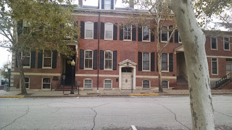
Photo
Where is located Cole County Historical Museum
Cole County Historical Museum — local attraction, which is located at 109 Madison St, Jefferson City, MO 65101, United States and belongs to the category — historical place museum. Average visitor rating for this place — 4.5 (according to 15 ratings, information from open sources and relevant for 2022).
Exact location — Cole County Historical Museum, marked on the map with a red marker.
You can get directions to Cole County Historical Museum on the map from your location.
What else is interesting in Jefferson City? You can see all the sights if you go to the city page.
Coordinates
Cole County Historical Museum, United States coordinates in decimal format: latitude — 38.57734933610475, longitude — -92.16940217510965. When converted to degrees, minutes, seconds Cole County Historical Museum has the following coordinates: 38°34′38.46 north latitude and -92°10′9.85 east longitude.
Nearby cities
The largest cities that are located nearby:
- Saint Louis — 171 km
- Springfield — 180 km
- Independence — 201 km
- Kansas City — 214 km
- North Kansas City — 215 km
- Overland Park — 219 km
- Olathe — 230 km
- Topeka — 306 km
- Peoria — 319 km
- Des Moines — 355 km
- Evansville — 407 km
- Little Rock — 424 km
- Memphis — 425 km
- Tulsa — 434 km
- Omaha — 434 km
- Lincoln — 452 km
- Wichita — 462 km
- Joliet — 470 km
- Aurora — 474 km
Distance to the capital
Distance to the capital (Washington) is about — 1312 km.