 Warner Robins
Wantagh
Bethel
Misty Hill Farm
United States
Wakonda Beach (R33) Airport
Wilmington
Poland
Miami International Airport
Warner Robins
Wantagh
Bethel
Misty Hill Farm
United States
Wakonda Beach (R33) Airport
Wilmington
Poland
Miami International Airport
Long Branch Lagoon on the map, Dodge City, United States
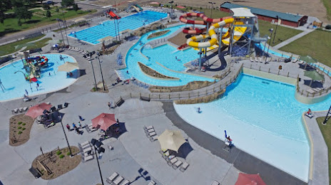
Photo
Where is located Long Branch Lagoon
Long Branch Lagoon — local attraction, which is located at 111 4th Ave, Dodge City, KS 67801, United States and belongs to the category — water park. Average visitor rating for this place — 4.5 (according to 379 ratings, information from open sources and relevant for 2022).
Exact location — Long Branch Lagoon, marked on the map with a red marker.
You can get directions to Long Branch Lagoon on the map from your location.
What else is interesting in Dodge City? You can see all the sights if you go to the city page.
Coordinates
Long Branch Lagoon, United States coordinates in decimal format: latitude — 37.75037080566115, longitude — -100.02256647513362. When converted to degrees, minutes, seconds Long Branch Lagoon has the following coordinates: 37°45′1.33 north latitude and -100°1′21.24 east longitude.
Nearby cities
The largest cities that are located nearby:
- Wichita — 235 km
- Amarillo — 324 km
- Oklahoma City — 338 km
- Norman — 364 km
- Topeka — 399 km
- Tulsa — 400 km
- Pueblo — 403 km
- Colorado Springs — 431 km
- Lincoln — 439 km
- Wichita Falls — 447 km
- Aurora — 464 km
- Olathe — 464 km
- Denver — 476 km
- Overland Park — 479 km
- Thornton — 481 km
- Lakewood — 482 km
- Westminster — 484 km
- Arvada — 487 km
- Kansas City — 490 km
Distance to the capital
Distance to the capital (Washington) is about — 2004 km.