 Warner Robins
Wantagh
Bethel
Misty Hill Farm
United States
Wakonda Beach (R33) Airport
Wilmington
Poland
Miami International Airport
Warner Robins
Wantagh
Bethel
Misty Hill Farm
United States
Wakonda Beach (R33) Airport
Wilmington
Poland
Miami International Airport
Iowa State Capitol on the map, Des Moines, United States
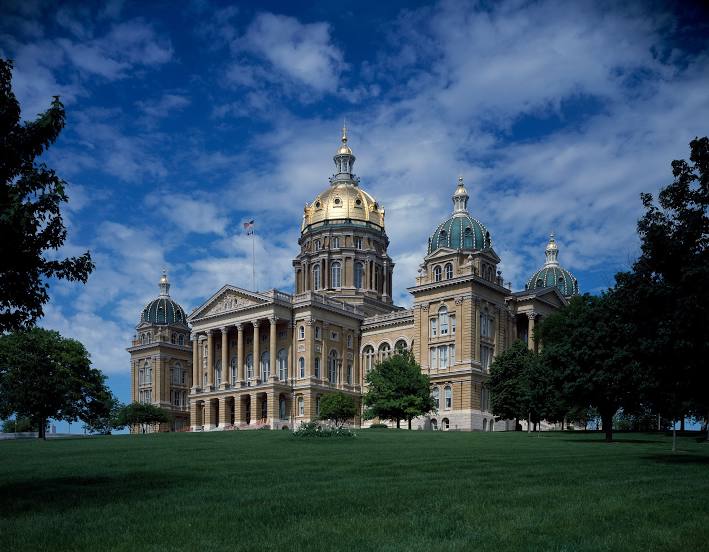
Photo
Where is located Iowa State Capitol
Iowa State Capitol — local attraction, which is located at 1007 E Grand Ave, Des Moines, IA 50319, United States and belongs to the category — building. Average visitor rating for this place — 4.8 (according to 1048 ratings, information from open sources and relevant for 2022).
Exact location — Iowa State Capitol, marked on the map with a red marker.
You can get directions to Iowa State Capitol on the map from your location.
What else is interesting in Des Moines? You can see all the sights if you go to the city page.
Coordinates
Iowa State Capitol, United States coordinates in decimal format: latitude — 41.59116607080112, longitude — -93.60370327501843. When converted to degrees, minutes, seconds Iowa State Capitol has the following coordinates: 41°35′28.2 north latitude and -93°36′13.33 east longitude.
Nearby cities
The largest cities that are located nearby:
- Omaha — 202 km
- Lincoln — 271 km
- North Kansas City — 284 km
- Independence — 286 km
- Kansas City — 289 km
- Overland Park — 304 km
- Olathe — 318 km
- Sioux Falls — 330 km
- Topeka — 333 km
- Peoria — 352 km
- Saint Paul — 373 km
- Minneapolis — 374 km
- Rockford — 377 km
- Madison — 377 km
- Aurora — 437 km
- Saint Louis — 441 km
- Naperville — 450 km
- Joliet — 458 km
- Springfield — 486 km
Distance to the capital
Distance to the capital (Washington) is about — 1435 km.