 Warner Robins
Wantagh
Bethel
Misty Hill Farm
United States
Wakonda Beach (R33) Airport
Wilmington
Poland
Miami International Airport
Warner Robins
Wantagh
Bethel
Misty Hill Farm
United States
Wakonda Beach (R33) Airport
Wilmington
Poland
Miami International Airport
Monterey Pines Golf Club on the map, Monterey, United States
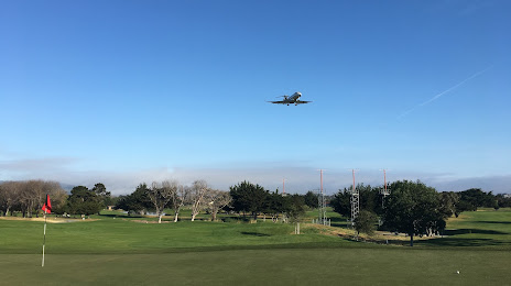
Photo
Where is located Monterey Pines Golf Club
Monterey Pines Golf Club — local attraction, which is located at 1250 Garden Rd, Monterey, CA 93940, United States and belongs to the category — golf course. Average visitor rating for this place — 4.5 (according to 137 ratings, information from open sources and relevant for 2022).
Exact location — Monterey Pines Golf Club, marked on the map with a red marker.
You can get directions to Monterey Pines Golf Club on the map from your location.
What else is interesting in Monterey? You can see all the sights if you go to the city page.
Coordinates
Monterey Pines Golf Club, United States coordinates in decimal format: latitude — 36.590588115438, longitude — -121.86427677516664. When converted to degrees, minutes, seconds Monterey Pines Golf Club has the following coordinates: 36°35′26.12 north latitude and -121°51′51.4 east longitude.
Nearby cities
The largest cities that are located nearby:
- Salinas — 23 km
- San Jose — 82 km
- Santa Clara — 84 km
- Sunnyvale — 86 km
- Fremont — 105 km
- Hayward — 119 km
- Oakland — 137 km
- San Francisco — 138 km
- Modesto — 139 km
- Berkeley — 144 km
- Richmond — 151 km
- Concord — 153 km
- Stockton — 159 km
- Vallejo — 169 km
- Fairfield — 183 km
- Fresno — 189 km
- Santa Rosa — 215 km
- Sacramento — 222 km
- Visalia — 234 km
Distance to the capital
Distance to the capital (Washington) is about — 3911 km.