 Warner Robins
Wantagh
Bethel
Misty Hill Farm
United States
Wakonda Beach (R33) Airport
Wilmington
Poland
Miami International Airport
Warner Robins
Wantagh
Bethel
Misty Hill Farm
United States
Wakonda Beach (R33) Airport
Wilmington
Poland
Miami International Airport
Couchville Cedar Glade State Natural Area on the map, La Vergne, United States
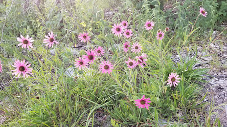
Photo
Where is located Couchville Cedar Glade State Natural Area
Couchville Cedar Glade State Natural Area — local attraction, which is located at Tyler Sykes Trail, Hermitage, TN 37076, United States and belongs to the category — state park. Average visitor rating for this place — 4.7 (according to 356 ratings, information from open sources and relevant for 2022).
Exact location — Couchville Cedar Glade State Natural Area, marked on the map with a red marker.
You can get directions to Couchville Cedar Glade State Natural Area on the map from your location.
What else is interesting in La Vergne? You can see all the sights if you go to the city page.
Coordinates
Couchville Cedar Glade State Natural Area, United States coordinates in decimal format: latitude — 36.09257676686621, longitude — -86.53805747518044. When converted to degrees, minutes, seconds Couchville Cedar Glade State Natural Area has the following coordinates: 36°5′33.28 north latitude and -86°32′17.01 east longitude.
Nearby cities
The largest cities that are located nearby:
- Nashville — 24 km
- Clarksville — 89 km
- Huntsville — 142 km
- Chattanooga — 157 km
- Evansville — 233 km
- Knoxville — 238 km
- Louisville — 257 km
- Birmingham — 277 km
- Atlanta — 322 km
- Memphis — 328 km
- Cincinnati — 385 km
- Montgomery — 404 km
- Indianapolis — 416 km
- Saint Louis — 425 km
- Springfield — 492 km
- Charlotte — 526 km
- Jackson — 531 km
- Columbus — 532 km
- Little Rock — 537 km
Distance to the capital
Distance to the capital (Washington) is about — 894 km.