 Warner Robins
Wantagh
Bethel
Misty Hill Farm
United States
Wakonda Beach (R33) Airport
Wilmington
Poland
Miami International Airport
Warner Robins
Wantagh
Bethel
Misty Hill Farm
United States
Wakonda Beach (R33) Airport
Wilmington
Poland
Miami International Airport
Vivrett Creek Public Use Area on the map, Mount Juliet, United States
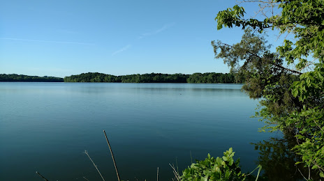
Photo
Where is located Vivrett Creek Public Use Area
Vivrett Creek Public Use Area — local attraction, which is located at 5598 Alvin Sperry Rd, Mt. Juliet, TN 37122, United States and belongs to the category — park. Average visitor rating for this place — 4.7 (according to 88 ratings, information from open sources and relevant for 2022).
Exact location — Vivrett Creek Public Use Area, marked on the map with a red marker.
You can get directions to Vivrett Creek Public Use Area on the map from your location.
What else is interesting in Mount Juliet? You can see all the sights if you go to the city page.
Coordinates
Vivrett Creek Public Use Area, United States coordinates in decimal format: latitude — 36.14153319117123, longitude — -86.54644327517912. When converted to degrees, minutes, seconds Vivrett Creek Public Use Area has the following coordinates: 36°8′29.52 north latitude and -86°32′47.2 east longitude.
Nearby cities
The largest cities that are located nearby:
- Nashville — 24 km
- Clarksville — 83 km
- Huntsville — 163 km
- Chattanooga — 168 km
- Evansville — 216 km
- Knoxville — 234 km
- Louisville — 236 km
- Birmingham — 297 km
- Atlanta — 334 km
- Memphis — 340 km
- Cincinnati — 364 km
- Indianapolis — 396 km
- Saint Louis — 416 km
- Montgomery — 424 km
- Springfield — 472 km
- Columbus — 512 km
- Charlotte — 524 km
- Little Rock — 548 km
- Jackson — 551 km
Distance to the capital
Distance to the capital (Washington) is about — 893 km.