 Warner Robins
Wantagh
Bethel
Misty Hill Farm
United States
Wakonda Beach (R33) Airport
Wilmington
Poland
Miami International Airport
Warner Robins
Wantagh
Bethel
Misty Hill Farm
United States
Wakonda Beach (R33) Airport
Wilmington
Poland
Miami International Airport
Spartanburg Science Center on the map, Spartanburg, United States
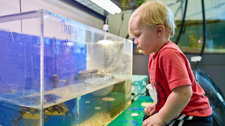
Photo
Where is located Spartanburg Science Center
Spartanburg Science Center — local attraction, which is located at 200 E St John St, Spartanburg, SC 29306, United States and belongs to the category — science museum. Average visitor rating for this place — 4.6 (according to 74 ratings, information from open sources and relevant for 2022).
Exact location — Spartanburg Science Center, marked on the map with a red marker.
You can get directions to Spartanburg Science Center on the map from your location.
What else is interesting in Spartanburg? You can see all the sights if you go to the city page.
Coordinates
Spartanburg Science Center, United States coordinates in decimal format: latitude — 34.96161300439197, longitude — -81.96995928252686. When converted to degrees, minutes, seconds Spartanburg Science Center has the following coordinates: 34°57′41.81 north latitude and -81°58′11.85 east longitude.
Nearby cities
The largest cities that are located nearby:
- Charlotte — 103 km
- Columbia — 133 km
- Winston-Salem — 197 km
- Knoxville — 210 km
- Greensboro — 228 km
- Atlanta — 262 km
- Fayetteville — 277 km
- Durham — 295 km
- Cary — 298 km
- Charleston — 304 km
- Chattanooga — 306 km
- Raleigh — 309 km
- Savannah — 326 km
- Huntsville — 424 km
- Nashville — 453 km
- Birmingham — 476 km
- Richmond — 487 km
- Louisville — 494 km
- Montgomery — 498 km
Distance to the capital
Distance to the capital (Washington) is about — 620 km.