 Warner Robins
Wantagh
Bethel
Misty Hill Farm
United States
Wakonda Beach (R33) Airport
Wilmington
Poland
Miami International Airport
Warner Robins
Wantagh
Bethel
Misty Hill Farm
United States
Wakonda Beach (R33) Airport
Wilmington
Poland
Miami International Airport
Matthaei Botanical Gardens & Nichols Arboretum on the map, Ann Arbor, United States
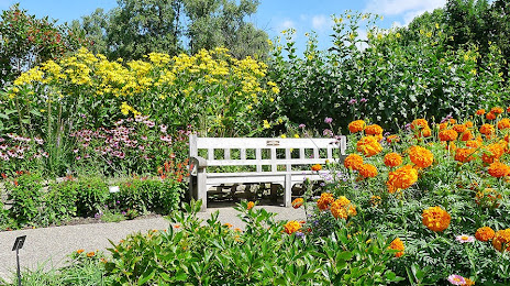
Photo
Where is located Matthaei Botanical Gardens & Nichols Arboretum
Matthaei Botanical Gardens & Nichols Arboretum — local attraction, which is located at 1800 N Dixboro Rd, Ann Arbor, MI 48105, United States and belongs to the category — botanical garden. Average visitor rating for this place — 4.8 (according to 2097 ratings, information from open sources and relevant for 2022).
Exact location — Matthaei Botanical Gardens & Nichols Arboretum, marked on the map with a red marker.
You can get directions to Matthaei Botanical Gardens & Nichols Arboretum on the map from your location.
What else is interesting in Ann Arbor? You can see all the sights if you go to the city page.
Coordinates
Matthaei Botanical Gardens & Nichols Arboretum, United States coordinates in decimal format: latitude — 42.302198071234834, longitude — -83.66326787499608. When converted to degrees, minutes, seconds Matthaei Botanical Gardens & Nichols Arboretum has the following coordinates: 42°18′7.91 north latitude and -83°39′47.76 east longitude.
Nearby cities
The largest cities that are located nearby:
- Detroit — 57 km
- Windsor
 (Canada) — 58 km
 - Warren — 65 km
- Sterling Heights — 67 km
- Toledo — 70 km
- Flint — 81 km
- Lansing — 83 km
- Grand Rapids — 173 km
- Fort Wayne — 177 km
- Cleveland — 190 km
- London (Canada) — 217 km
- South Bend — 218 km
- Aurora — 226 km
- Akron — 228 km
- Springfield — 261 km
- Columbus — 264 km
- Waterloo (Canada) — 290 km
- Kitchener (Canada) — 291 km
- Cambridge (Canada) — 300 km
Distance to the capital
Distance to the capital (Washington) is about — 675 km.