 Warner Robins
Wantagh
Bethel
Misty Hill Farm
United States
Wakonda Beach (R33) Airport
Wilmington
Poland
Miami International Airport
Warner Robins
Wantagh
Bethel
Misty Hill Farm
United States
Wakonda Beach (R33) Airport
Wilmington
Poland
Miami International Airport
West Rock Ridge on the map, New Haven, United States
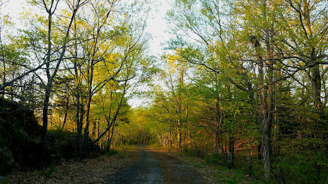
Photo
Where is located West Rock Ridge
West Rock Ridge — local attraction, which is located at 700 ft (210 m)ridge high point and belongs to the category — -. Average visitor rating for this place — 4.7 (according to 3 ratings, information from open sources and relevant for 2022).
Exact location — West Rock Ridge, marked on the map with a red marker.
You can get directions to West Rock Ridge on the map from your location.
What else is interesting in New Haven? You can see all the sights if you go to the city page.
Coordinates
West Rock Ridge, United States coordinates in decimal format: latitude — 41.34461243324706, longitude — -72.96621487502605. When converted to degrees, minutes, seconds West Rock Ridge has the following coordinates: 41°20′40.6 north latitude and -72°57′58.37 east longitude.
Nearby cities
The largest cities that are located nearby:
- Bridgeport — 26 km
- Waterbury — 29 km
- Hartford — 54 km
- Stamford — 58 km
- Yonkers — 91 km
- Springfield — 92 km
- New York — 112 km
- Brooklyn — 112 km
- Paterson — 113 km
- Amherst — 119 km
- Newark — 122 km
- Elizabeth — 129 km
- Providence — 137 km
- Worcester — 140 km
- Edison — 152 km
- Toms River — 184 km
- Cambridge — 190 km
- Boston — 192 km
- Lowell — 197 km
Distance to the capital
Distance to the capital (Washington) is about — 440 km.