 Warner Robins
Wantagh
Bethel
Misty Hill Farm
United States
Wakonda Beach (R33) Airport
Wilmington
Poland
Miami International Airport
Warner Robins
Wantagh
Bethel
Misty Hill Farm
United States
Wakonda Beach (R33) Airport
Wilmington
Poland
Miami International Airport
Newport County on the map, Newport, United States
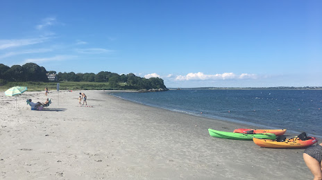
Photo
Where is located Newport County
Newport County — local attraction, which is located at 1703 and belongs to the category — -. Average visitor rating for this place — 4.5 (according to 214 ratings, information from open sources and relevant for 2022).
Exact location — Newport County, marked on the map with a red marker.
You can get directions to Newport County on the map from your location.
What else is interesting in Newport? You can see all the sights if you go to the city page.
Coordinates
Newport County, United States coordinates in decimal format: latitude — 41.489726414125826, longitude — -71.24803297502163. When converted to degrees, minutes, seconds Newport County has the following coordinates: 41°29′23.02 north latitude and -71°14′52.92 east longitude.
Nearby cities
The largest cities that are located nearby:
- Providence — 38 km
- Worcester — 94 km
- Boston — 98 km
- Cambridge — 99 km
- Hartford — 117 km
- Springfield — 125 km
- Lowell — 126 km
- Amherst — 135 km
- New Haven — 136 km
- Waterbury — 144 km
- Bridgeport — 160 km
- Manchester — 167 km
- Stamford — 192 km
- Yonkers — 225 km
- Brooklyn — 241 km
- New York — 242 km
- Paterson — 247 km
- Newark — 254 km
- Elizabeth — 260 km
Distance to the capital
Distance to the capital (Washington) is about — 569 km.