 Warner Robins
Wantagh
Bethel
Misty Hill Farm
United States
Wakonda Beach (R33) Airport
Wilmington
Poland
Miami International Airport
Warner Robins
Wantagh
Bethel
Misty Hill Farm
United States
Wakonda Beach (R33) Airport
Wilmington
Poland
Miami International Airport
Middleton Area Historical Society on the map, Madison, United States
Photo
Where is located Middleton Area Historical Society
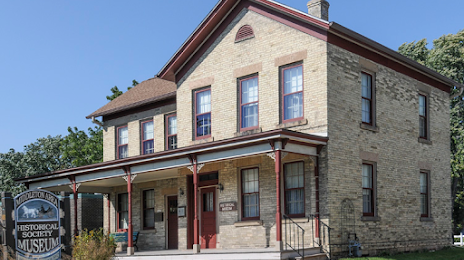
Middleton Area Historical Society — local attraction, which is located at 7410 Hubbard Ave, Middleton, WI 53562, United States and belongs to the category — history museum. Average visitor rating for this place — 4.8 (according to 5 ratings, information from open sources and relevant for 2022).
Exact location — Middleton Area Historical Society, marked on the map with a red marker.
You can get directions to Middleton Area Historical Society on the map from your location.
What else is interesting in Madison? You can see all the sights if you go to the city page.
Coordinates
Middleton Area Historical Society, United States coordinates in decimal format: latitude — 43.095325224402586, longitude — -89.50891767497085. When converted to degrees, minutes, seconds Middleton Area Historical Society has the following coordinates: 43°5′43.17 north latitude and -89°30′32.1 east longitude.
Nearby cities
The largest cities that are located nearby:
- Rockford — 92 km
- Milwaukee — 121 km
- Aurora — 170 km
- Naperville — 179 km
- Green Bay — 193 km
- Chicago — 197 km
- Joliet — 203 km
- Peoria — 264 km
- Grand Rapids — 302 km
- South Bend — 302 km
- Saint Paul — 356 km
- Minneapolis — 368 km
- Des Moines — 384 km
- Lansing — 395 km
- Fort Wayne — 418 km
- Indianapolis — 458 km
- Flint — 462 km
- Ann Arbor — 471 km
- Saint Louis — 496 km
Distance to the capital
Distance to the capital (Washington) is about — 1144 km.