 Warner Robins
Wantagh
Bethel
Misty Hill Farm
United States
Wakonda Beach (R33) Airport
Wilmington
Poland
Miami International Airport
Warner Robins
Wantagh
Bethel
Misty Hill Farm
United States
Wakonda Beach (R33) Airport
Wilmington
Poland
Miami International Airport
Museum of Idaho on the map, Idaho Falls, United States
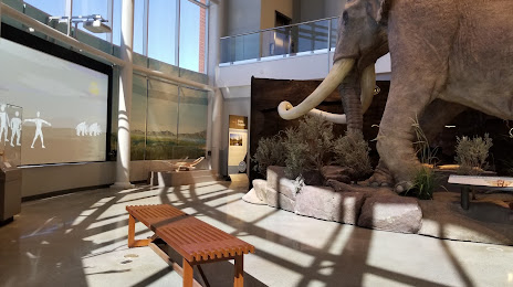
Photo
Where is located Museum of Idaho
Museum of Idaho — local attraction, which is located at 200 N Eastern Ave, Idaho Falls, ID 83402, United States and belongs to the category — museum. Average visitor rating for this place — 4.5 (according to 1200 ratings, information from open sources and relevant for 2022).
Exact location — Museum of Idaho, marked on the map with a red marker.
You can get directions to Museum of Idaho on the map from your location.
What else is interesting in Idaho Falls? You can see all the sights if you go to the city page.
Coordinates
Museum of Idaho, United States coordinates in decimal format: latitude — 43.491561859935274, longitude — -112.03576897733936. When converted to degrees, minutes, seconds Museum of Idaho has the following coordinates: 43°29′29.62 north latitude and -112°2′8.77 east longitude.
Nearby cities
The largest cities that are located nearby:
- Salt Lake City — 302 km
- West Valley City — 310 km
- West Jordan — 319 km
- Boise — 335 km
- Provo — 362 km
- Spokane — 611 km
- Fort Collins — 666 km
- Arvada — 717 km
- Westminster — 718 km
- Thornton — 721 km
- Lakewood — 725 km
- Denver — 729 km
- Aurora — 740 km
- Reno — 795 km
- Colorado Springs — 807 km
- Calgary
 (Canada) — 847 km
 - North Las Vegas — 852 km
- Portland — 854 km
- Vancouver — 855 km
Distance to the capital
Distance to the capital (Washington) is about — 2951 km.