 Warner Robins
Wantagh
Bethel
Misty Hill Farm
United States
Wakonda Beach (R33) Airport
Wilmington
Poland
Miami International Airport
Warner Robins
Wantagh
Bethel
Misty Hill Farm
United States
Wakonda Beach (R33) Airport
Wilmington
Poland
Miami International Airport
Tualatin River National Wildlife Refuge Visitor Center on the map, Tualatin, United States
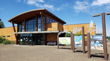
Photo
Where is located Tualatin River National Wildlife Refuge Visitor Center
Tualatin River National Wildlife Refuge Visitor Center — local attraction, which is located at 19255 SW Pacific Hwy, Sherwood, OR 97140, United States and belongs to the category — wildlife refuge. Average visitor rating for this place — 4.6 (according to 1209 ratings, information from open sources and relevant for 2022).
Exact location — Tualatin River National Wildlife Refuge Visitor Center, marked on the map with a red marker.
You can get directions to Tualatin River National Wildlife Refuge Visitor Center on the map from your location.
What else is interesting in Tualatin? You can see all the sights if you go to the city page.
Coordinates
Tualatin River National Wildlife Refuge Visitor Center, United States coordinates in decimal format: latitude — 45.382157568625, longitude — -122.83230027489593. When converted to degrees, minutes, seconds Tualatin River National Wildlife Refuge Visitor Center has the following coordinates: 45°22′55.77 north latitude and -122°49′56.28 east longitude.
Nearby cities
The largest cities that are located nearby:
- Portland — 17 km
- Vancouver — 29 km
- Salem — 53 km
- Eugene — 149 km
- Tacoma — 208 km
- Seattle — 248 km
- Bellevue — 250 km
- Victoria
 (Canada) — 339 km
 - Abbotsford (Canada) — 407 km
- Delta (Canada) — 411 km
- Richmond (Canada) — 419 km
- Surrey (Canada) — 420 km
- Burnaby (Canada) — 430 km
- Coquitlam (Canada) — 431 km
- Anmore (Canada) — 435 km
- Spokane — 470 km
- Kelowna (Canada) — 550 km
- Boise — 559 km
- Reno — 694 km
Distance to the capital
Distance to the capital (Washington) is about — 3792 km.