 Warner Robins
Wantagh
Bethel
Misty Hill Farm
United States
Wakonda Beach (R33) Airport
Wilmington
Poland
Miami International Airport
Warner Robins
Wantagh
Bethel
Misty Hill Farm
United States
Wakonda Beach (R33) Airport
Wilmington
Poland
Miami International Airport
Blackhawk Springs Forest Preserve on the map, Rockford, United States
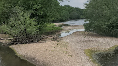
Photo
Where is located Blackhawk Springs Forest Preserve
Blackhawk Springs Forest Preserve — local attraction, which is located at 5360 Mulford Road &, 5801 Perryville Rd, Rockford, IL 61109, United States and belongs to the category — park. Average visitor rating for this place — 4.6 (according to 357 ratings, information from open sources and relevant for 2022).
Exact location — Blackhawk Springs Forest Preserve, marked on the map with a red marker.
You can get directions to Blackhawk Springs Forest Preserve on the map from your location.
What else is interesting in Rockford? You can see all the sights if you go to the city page.
Coordinates
Blackhawk Springs Forest Preserve, United States coordinates in decimal format: latitude — 42.20465811597546, longitude — -88.9917006749992. When converted to degrees, minutes, seconds Blackhawk Springs Forest Preserve has the following coordinates: 42°12′16.77 north latitude and -88°59′30.12 east longitude.
Nearby cities
The largest cities that are located nearby:
- Aurora — 85 km
- Madison — 92 km
- Naperville — 97 km
- Joliet — 118 km
- Milwaukee — 128 km
- Chicago — 128 km
- Peoria — 179 km
- South Bend — 244 km
- Green Bay — 263 km
- Grand Rapids — 288 km
- Fort Wayne — 355 km
- Lansing — 372 km
- Indianapolis — 373 km
- Des Moines — 381 km
- Saint Louis — 414 km
- Saint Paul — 431 km
- Ann Arbor — 438 km
- Minneapolis — 443 km
- Flint — 445 km
Distance to the capital
Distance to the capital (Washington) is about — 1074 km.