 Warner Robins
Wantagh
Bethel
Misty Hill Farm
United States
Wakonda Beach (R33) Airport
Wilmington
Poland
Miami International Airport
Warner Robins
Wantagh
Bethel
Misty Hill Farm
United States
Wakonda Beach (R33) Airport
Wilmington
Poland
Miami International Airport
Chesterley Park on the map, Yakima, United States
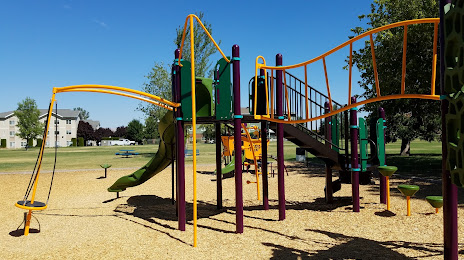
Photo
Where is located Chesterley Park
Chesterley Park — local attraction, which is located at 40th Ave and River Road, Yakima, WA 98902, United States and belongs to the category — park. Average visitor rating for this place — 4.3 (according to 461 rating, information from open sources and relevant for 2022).
Exact location — Chesterley Park, marked on the map with a red marker.
You can get directions to Chesterley Park on the map from your location.
What else is interesting in Yakima? You can see all the sights if you go to the city page.
Coordinates
Chesterley Park, United States coordinates in decimal format: latitude — 46.597975881367354, longitude — -120.58401839002313. When converted to degrees, minutes, seconds Chesterley Park has the following coordinates: 46°35′52.71 north latitude and -120°35′2.47 east longitude.
Nearby cities
The largest cities that are located nearby:
- Tacoma — 162 km
- Bellevue — 168 km
- Seattle — 176 km
- Vancouver — 198 km
- Portland — 206 km
- Spokane — 257 km
- Salem — 270 km
- Victoria
 (Canada) — 291 km
 - Abbotsford (Canada) — 302 km
- Delta (Canada) — 331 km
- Surrey (Canada) — 332 km
- Coquitlam (Canada) — 339 km
- Richmond (Canada) — 341 km
- Burnaby (Canada) — 344 km
- Anmore (Canada) — 344 km
- Eugene — 349 km
- Kelowna (Canada) — 370 km
- Boise — 476 km
- Calgary (Canada) — 665 km
Distance to the capital
Distance to the capital (Washington) is about — 3609 km.