 Warner Robins
Wantagh
Bethel
Misty Hill Farm
United States
Wakonda Beach (R33) Airport
Wilmington
Poland
Miami International Airport
Warner Robins
Wantagh
Bethel
Misty Hill Farm
United States
Wakonda Beach (R33) Airport
Wilmington
Poland
Miami International Airport
Smoky Rose Cellars on the map, Walla Walla, United States
Photo
Where is located Smoky Rose Cellars
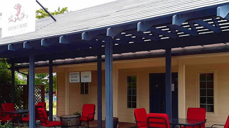
Smoky Rose Cellars — local attraction, which is located at 2428 Heritage Rd, Walla Walla, WA 99362, United States and belongs to the category — winery. Average visitor rating for this place — 5.0 (according to 9 ratings, information from open sources and relevant for 2022).
Exact location — Smoky Rose Cellars, marked on the map with a red marker.
You can get directions to Smoky Rose Cellars on the map from your location.
What else is interesting in Walla Walla? You can see all the sights if you go to the city page.
Coordinates
Smoky Rose Cellars, United States coordinates in decimal format: latitude — 46.068295682603505, longitude — -118.39415427487286. When converted to degrees, minutes, seconds Smoky Rose Cellars has the following coordinates: 46°4′5.86 north latitude and -118°23′38.96 east longitude.
Nearby cities
The largest cities that are located nearby:
- Spokane — 189 km
- Boise — 320 km
- Bellevue — 335 km
- Tacoma — 335 km
- Vancouver — 337 km
- Portland — 341 km
- Seattle — 343 km
- Salem — 388 km
- Kelowna
 (Canada) — 431 km
 - Eugene — 438 km
- Abbotsford (Canada) — 439 km
- Victoria (Canada) — 452 km
- Surrey (Canada) — 474 km
- Delta (Canada) — 477 km
- Coquitlam (Canada) — 479 km
- Anmore (Canada) — 485 km
- Burnaby (Canada) — 486 km
- Richmond (Canada) — 487 km
- Calgary (Canada) — 626 km
Distance to the capital
Distance to the capital (Washington) is about — 3443 km.