 Warner Robins
Wantagh
Bethel
Misty Hill Farm
United States
Wakonda Beach (R33) Airport
Wilmington
Poland
Miami International Airport
Warner Robins
Wantagh
Bethel
Misty Hill Farm
United States
Wakonda Beach (R33) Airport
Wilmington
Poland
Miami International Airport
Historic Fort Steuben on the map, Steubenville, United States
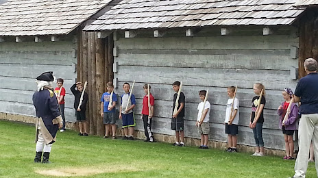
Photo
Where is located Historic Fort Steuben
Historic Fort Steuben — local attraction, which is located at 120 S 3rd St, Steubenville, OH 43952, United States and belongs to the category — history museum. Average visitor rating for this place — 4.6 (according to 534 ratings, information from open sources and relevant for 2022).
Exact location — Historic Fort Steuben, marked on the map with a red marker.
You can get directions to Historic Fort Steuben on the map from your location.
What else is interesting in Steubenville? You can see all the sights if you go to the city page.
Coordinates
Historic Fort Steuben, United States coordinates in decimal format: latitude — 40.35803968958832, longitude — -80.61300367505642. When converted to degrees, minutes, seconds Historic Fort Steuben has the following coordinates: 40°21′28.94 north latitude and -80°36′46.81 east longitude.
Nearby cities
The largest cities that are located nearby:
- Pittsburgh — 54 km
- Akron — 108 km
- Aurora — 120 km
- Cleveland — 153 km
- Columbus — 205 km
- Springfield — 274 km
- Toledo — 281 km
- Windsor
 (Canada) — 291 km
 - Detroit — 293 km
- London (Canada) — 294 km
- Boston — 294 km
- Warren — 306 km
- Buffalo — 312 km
- Sterling Heights — 313 km
- Amherst — 324 km
- Hamilton (Canada) — 324 km
- Saint Catharines (Canada) — 328 km
- Ann Arbor — 331 km
- Cambridge (Canada) — 332 km
Distance to the capital
Distance to the capital (Washington) is about — 346 km.